
Bodmin Moor: granite moorland in northeastern Cornwall
Bodmin Moor is a granite moorland in northeastern Cornwall, England. Noted for its tors, Bronze Age archaeology, upland habitats and rivers that rise within it, it remains a working and protected landscape.
Overview
Bodmin Moor is an upland area of moorland in northeastern Cornwall, United Kingdom. Covering roughly 208 square kilometres (around 80 sq mi), it is characterised by open heather and peat, scattered granite outcrops and a network of small rivers and streams. The rocks that underlie the moor are predominantly granite, emplaced during deep crustal activity, and much of the surface shows the long-term effects of weathering and peat accumulation. The landscape seen today reflects both ancient geology and centuries of human use.
Image gallery
10 Images





Geology and landscape
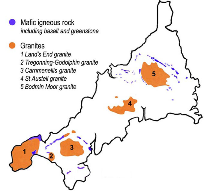
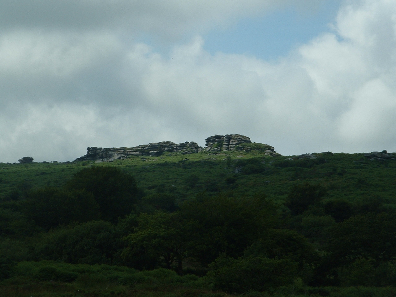
Bodmin Moor is one of the granite plutons in Cornwall, formed as molten rock intruded into older rocks during Earth’s distant tectonic past. The slow cooling and later exposure of that granite produced the rounded, blocky outcrops known as tors. The moor contains high points such as Brown Willy — the county's highest summit — and nearby Roughtor. Peat bogs occupy hollows between the rock outcrops and store water that feeds rivers. Several rivers rise on the moor, including the headwaters of the River Fowey and others that drain to both north and south coasts.
History and archaeology
Human presence on Bodmin Moor goes back to prehistoric times. Bronze Age field systems, burial cairns, standing stones and hut circles are common across the moor and testify to early farming and ritual activity. The name "Bodmin Moor" itself is comparatively modern, first recorded in the early 19th century; earlier maps and accounts referred to the area by other local names such as Fowey Moor, after the river that rises there. From the medieval period onward the moor was used for rough grazing, and in later centuries tracks evolved into the trunk roads that cross it. One long-lived cultural association is with the 19th-century coaching inn and smuggling legends preserved in literature set on the moor.
Ecology and land use
The moor supports upland heath and bog habitats dominated by heather, gorse and sedges; these provide habitat for ground-nesting birds, insects and other upland species adapted to exposed, acidic soils. Much of Bodmin Moor is working countryside: sheep and some cattle graze the open land, and in places historic mining and quarrying have left their mark. Modern conservation efforts aim to balance farming, archaeological preservation and public access while addressing issues such as peat erosion and invasive species.
Recreation, economy and access
Bodmin Moor is a popular area for walking, birdwatching and studying archaeology. Rural lanes and rights of way cross the landscape, and a major road has crossed the moor since the 18th century, improving access to nearby towns. Visitors are encouraged to follow local guidance to protect fragile peat and archaeological sites. The moor also contributes to Cornwall’s rural economy through livestock grazing, small-scale tourism and the interpretation of its industrial and prehistoric heritage.
Notable places and facts
- High points: Brown Willy (the county high point) and Roughtor provide panoramic views.
- Granite tors such as the Cheesewring and other rock formations are distinctive landmarks.
- Many Bronze Age burial mounds, hut circles and stone rows are scattered across the moor.
- The River Fowey rises within the moor; other streams drain to different coasts.
For further general reading about the geology and landscape of Cornwall and granite moorlands see resources on granite, upland moorland, regional accounts of Cornwall and historical references linked to the River Fowey. When visiting, treat the moor respectfully: its peat and archaeological remains are valuable and vulnerable elements of a landscape shaped over millennia.
Questions and answers
Q: What is Bodmin Moor?
A: Bodmin Moor is a granite moorland in northeastern Cornwall, United Kingdom.
Q: What is the size of Bodmin Moor?
A: Bodmin Moor is 208 square kilometres (80 sq mi) in size.
Q: When did Bodmin Moor originally date from?
A: Bodmin Moor originally dates from the Carboniferous period of geological history.
Q: How many granite plutons are there in Cornwall?
A: Bodmin Moor is one of five granite plutons in Cornwall.
Q: What was Bodmin Moor formerly known as?
A: Bodmin Moor was formerly known as Fowey Moor after the River Fowey which rises within it.
Q: When was the name 'Bodmin Moor' invented?
A: The name 'Bodmin Moor' was invented in 1813.
Q: Which trunk road has been crossing Bodmin Moor since the mid 18th century?
A: The trunk road now known as the A30 has been crossing Bodmin Moor since the mid 18th century.
Related articles
Author
AlegsaOnline.com Bodmin Moor: granite moorland in northeastern Cornwall Leandro Alegsa
URL: https://en.alegsaonline.com/art/12603
Sources
- petrology.oxfordjournals.org : petrology.oxfordjournals.org/cgi/content/abstract/27/3/571
- genuki.org.uk : "Genuki: Cornwall, Cornwall"
- bodminmoor.co.uk : "The Bodmin Moor Pages ~ The History"
- cornwall-aonb.gov.uk : cornwall-aonb.gov.uk
- cornwallriversproject.org.uk : "Cornwall Rivers Project - Geography - Fowey and Lerryn"
- cornwallriversproject.org.uk : "Cornwall Rivers Project - Geography - Camel and Allen"