List of Ottawa neighbourhoods
Organized guide to neighbourhoods in Ottawa, grouped by location and character, with summaries of notable features, history, and pointers for exploring local community resources.
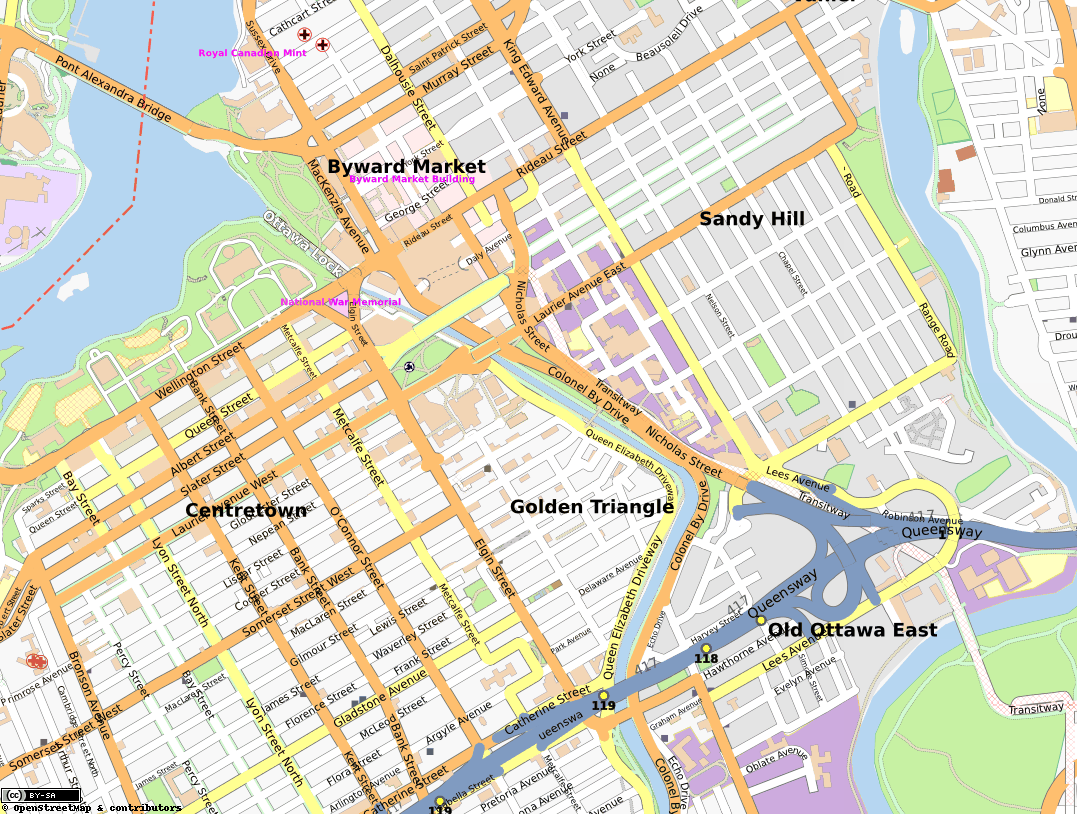
Ottawa, the capital of Canada, is made up of many named neighbourhoods that range from a dense downtown core to historic villages and modern suburban communities. Names used by residents, business improvement areas and community associations often matter more than exact administrative borders. Natural features — the Ottawa River, the Rideau River and the Rideau Canal — along with major roads and transit corridors, help define local districts.
Image gallery
3 Images

How the city is organized
Since municipal amalgamation in 2001, the present City of Ottawa includes formerly independent towns and villages such as Kanata, Nepean and Gloucester. Many neighbourhood names predate amalgamation and are still used by local associations, schools and businesses. Official ward boundaries and community association maps provide one form of reference, but neighbourhood boundaries remain informal and can overlap.
Grouped neighbourhoods and brief descriptions
The following groups approximate location or character to help navigate the many neighbourhood names found across the city.
- Downtown and central districts: Downtown (central business district), ByWard Market (historic market and nightlife area), Lowertown/Lower Town (bilingual, mixed residential and commercial), Sandy Hill (near the university), The Glebe (residential streets with shops along Bank Street), Chinatown and Little Italy (concentrated cultural and dining corridors), Wellington Village, Centretown, Civic Hospital area.
- Historic and diplomatic areas: New Edinburgh (riverside village with historic homes), Rockcliffe Park (large lots and embassies), Manor Park, Lindenlea, Old Ottawa South (riverfront community south of the canal).
- East and Orléans area: Vanier (historic francophone and working‑class area), Overbrook, Blackburn Hamlet (planned village), Beacon Hill and Beacon Hill North, Convent Glen, Chapel Hill, Fallingbrook, Orleans Wood, Queenswood Heights, Nottingate.
- South and riverfront neighbourhoods: Alta Vista (long-established residential area), Carleton Heights, Riverside and Riverside Park (along the Rideau River), Heron Park, Mooney’s Bay (recreation and swimming area), Hunt Club, McKellar Park.
- West and inner‑west districts: Hintonburg (shops and artists), Wellington Village, Westboro (retail and recreation along the river), Island Park, Bayshore and Britannia (riverfront recreation), Bells Corners (western commercial hub), Crystal Beach.
- Suburbs and planned communities: Kanata and Kanata Lakes (technology and suburban neighbourhoods), Morgan’s Grant, Stittsville (former village with ongoing growth), Bridlewood, Avalon, Merivale and surrounding corridors, Arlington Woods, Beaverbrook.
- Other notable neighbourhoods: Tunney’s Pasture (federal office campus), Uplands (near Ottawa’s main airport), Rockcliffe Park versus Rockcliffe neighbourhoods, Pineview, Pineridge, Ridgemont, Rothwell Heights, Beacon extensions, Village Green, Sunnridge, Tanglewood, Chatelaine Village.
Character and notable functions
Certain neighbourhoods play identifiable roles: the ByWard Market and nearby streets are long-established commercial and tourist areas; many central neighbourhoods combine apartment housing, shops and cultural venues; Rockcliffe Park and parts of New Edinburgh contain diplomatic residences and institutional grounds; suburban areas such as Kanata Lakes and Stittsville reflect post‑war and late 20th‑century growth, with family-oriented housing, schools and shopping nodes.
History and development
Ottawa’s pattern of neighbourhoods reflects successive waves of development: 19th‑century neighbourhoods clustered near the parliamentary precinct and riverfront; mid‑20th‑century suburban expansion tied to automobile travel and federal employment; and late 20th to early 21st‑century planned communities and infill development. The 2001 amalgamation formally brought many adjacent municipalities into a single city, broadening the recognised catalogue of neighbourhood names and community organizations.
Planning, services and community life
City planning documents, neighbourhood profiles and community association pages offer more precise boundary information, local histories and current planning issues. Public transit corridors (including light rail and bus routes), major roads and park systems influence where services and amenities cluster. Many neighbourhoods host active community associations, business improvement areas (BIAs) or local festivals that help define local identity.
Using this list
This compilation is intended as a practical starting index rather than a definitive map. For property searches, school catchment, transit planning or local events, consult the City of Ottawa’s official maps and the relevant community association. Local names and spelling variants are common; when in doubt, check municipal or neighbourhood resources for the most current information.
Questions and answers
Q: What are some neighbourhoods in Ottawa?
A: Alta Vista, Arlington Woods, Avalon Bayshore, Beacon Hill, Beaverbrook, Beechwood, Bells Corners, Blackburn Hamlet, Bridlewood, Britannia, Byward Market, Carleton Heights Carson Grove Centrepointe Chapel Hill Chateauneuf Chatelaine Village Chinatown Civic Hospital Convent Glen Craig Henry Crystal Beach Downtown Elmvale Acres Emerald Meadows Fallingbrook Gardenway Glencairn Heron Park Hiawatha Park Hintonburg Hunt Club Island Park Kanata Lakes Katimavik Lindenlea Little Italy Lowertown Manor Park McKellar Park Merivale Mooney's Bay Morgan's Grant New Edinburgh Nottingate Old Ottawa South Orleans Wood Overbrook Pineridge Pineview Pineview Pleasant Park Queenswood Heights Ridgemont Riverside Riverside Park Rockliffe Rockliffe Park Rothwell heights Sandy Hill Stittsville Sunridge Tanglewood The Glebe Tunnys Pasture Uplands Vanier Village Green Wellington Village Westboro.
Q: What is the name of a neighbourhood located in Ottawa?
A: Alta Vista Arlington Woods Avalon Bayshore Beacon Hill Beaverbrook Beechwood Bells corners Blackburn Hamlet Bridlewood Britannia Byward Market Carleton Heights Carson Grove Centrepointe Chapel Hill Chateauneuf Chatelaine Village Chinatown Civic Hospital Convent Glen Craig Henry Crystal Beach Downtown Elmvale Acres Emerald Meadows Fallingbrook Gardenway Glencairn Heron Park Hiawatha Park Hintonburg Hunt Club Island Park Kanata Lakes Katimavik Lindenlea Little Italy Lowertown Manor Park McKellar Park Merivale Mooney's Bay Morgan's Grant New Edinburgh Nottingate Old Ottawa South Orleans Wood Overbrook Pineridge Pineview Pineview Pleasant Park Queenswood Heights Ridgemont Riverside Riverside park Rockliffe Rockliffe park Rothwell heights Sandy Hill Stittsville Sunridge Tanglewood The Glebe Tunnys Pasture Uplands Vanier Village Green Wellington village Westboro.
Q: Is there a neighbourhood called 'Chapel Hill' in Ottawa?
A: Yes there is a neighbourhood called 'Chapel Hill' located in Ottawa.
Related articles
Author
AlegsaOnline.com List of Ottawa neighbourhoods Leandro Alegsa
URL: https://en.alegsaonline.com/art/124892