
Blisland, Cornwall: village and rural parish
Blisland is a small village and civil parish on the northeastern edge of Bodmin Moor in Cornwall, England, known for moorland, farmland and a dispersed rural community.
Overview
Blisland is a village and civil parish in the county of Cornwall in the United Kingdom. It lies about five miles northeast of Bodmin, close to the fringe of Bodmin Moor and set within a largely rural landscape. At the 2001 census the parish population was recorded as 565; the community remains small and dispersed, with the village serving as a local focus for farming and village life.
Image gallery
7 Images




Landscape and character
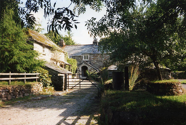
The parish combines upland moor to the northeast with lower-lying farmland to the southwest. Granite outcrops, hedged fields and lanes are typical across the agricultural areas, while patches of moorland provide open heath and rough grazing. The mix of terrain supports agricultural activity, wildlife habitats and opportunities for walking across scenic countryside adjacent to Bodmin Moor.
Parish boundaries and neighbouring communities
Blisland is bordered by a number of neighbouring parishes; these form the local administrative and historic context. To the north lies St Breward, to the west are St Mabyn and Helland, and to the south sit Cardinham and Warleggan together with St Neot. On the northeast the parish meets Altarnun. These links reflect traditional rural settlement patterns and lanes connecting the communities.
History and settlement
Like many Cornish parishes, Blisland has roots reaching back several centuries. The village grew around agriculture and local parish institutions; surviving buildings and field patterns reflect long-standing farmed landscapes. Historic features and local heritage may include traditional cottages, farm buildings and elements of the parish church and graveyard, which together point to a continuity of rural life.
Economy, recreation and importance
Agriculture remains central to the parish economy, with mixed livestock and arable farming common in the lower fields. Proximity to Bodmin Moor also brings recreational visitors: walkers, nature enthusiasts and those seeking quiet countryside. The area contributes to Cornish rural character and offers an example of moorland-edge communities balancing farming, conservation and small-scale tourism.
Notable facts and distinctions
Blisland exemplifies a small Cornish parish where moorland and farmland meet. Its position northeast of Bodmin and the pattern of neighbouring parishes are often cited when describing the local geography. For visitors and residents alike, the parish represents a tranquil part of Cornwall’s inland countryside within reach of Bodmin’s services and the wider landscapes of the moor.
Further local details, maps and historical records can be consulted through county resources and parish archives for those researching family history, land use or local heritage in Blisland.
Questions and answers
Q: What is Blisland?
A: Blisland is a village and parish in Cornwall, United Kingdom.
Q: How far is Blisland from Bodmin?
A: Blisland is about five miles northeast of Bodmin.
Q: What was the population of Blisland according to the 2001 census?
A: According to the 2001 census, the parish had a population of 565.
Q: What kind of character does the parish have?
A: The parish is rural in character.
Q: What is the landscape like in the northeast of the parish?
A: The northeast of the parish is moorland.
Q: What parishes border Blisland?
A: Blisland is bordered to the north by St Breward parish; to the west by St Mabyn and Helland parishes; to the south by Cardinham, Warleggan, and St Neot parishes; and to the northeast by Altarnun parish.
Q: What kind of landscape characterizes the southwest of the parish?
A: The southwest of the parish is lower lying farmland.
Related articles
Author
AlegsaOnline.com Blisland, Cornwall: village and rural parish Leandro Alegsa
URL: https://en.alegsaonline.com/art/12191
Sources
- mapping.cornwall.gov.uk : mapping.cornwall.gov.uk