
2010–2011 Queensland floods
A major series of floods that struck Queensland, Australia, from December 2010 to January 2011, driven by a strong La Niña, cyclone activity and record rainfall that inundated vast areas and affected hundreds of thousands.
Overview
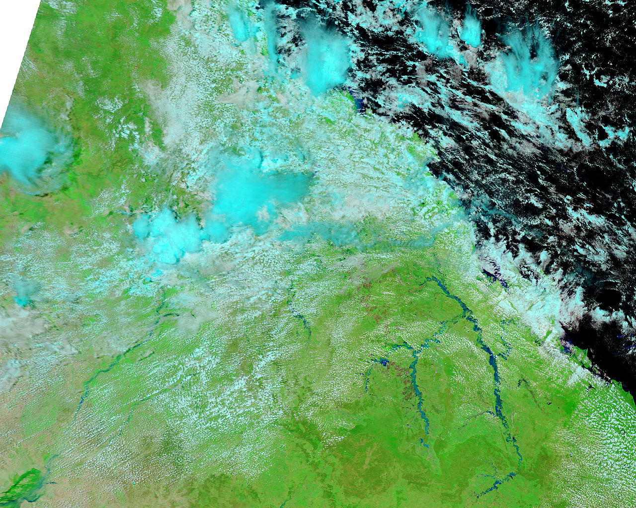
The 2010–2011 Queensland floods were an extended sequence of damaging floods that began in late 2010 and continued into early 2011 across eastern Australia. Heavy, persistent rainfall produced widespread inundation across much of the state of Queensland and caused additional flooding in parts of central and western Victoria. Urban areas, regional towns and rural catchments were affected: Brisbane, the state capital, experienced major riverine flooding, while at least 70 towns reported significant inundation and many smaller communities were forced to evacuate. The events affected hundreds of thousands of people and claimed dozens of lives. For contemporary reports and summaries see overview material and national coverage here.
Image gallery
10 Images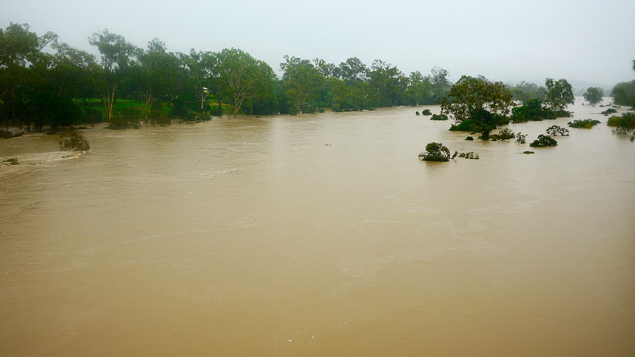


Causes and meteorological background
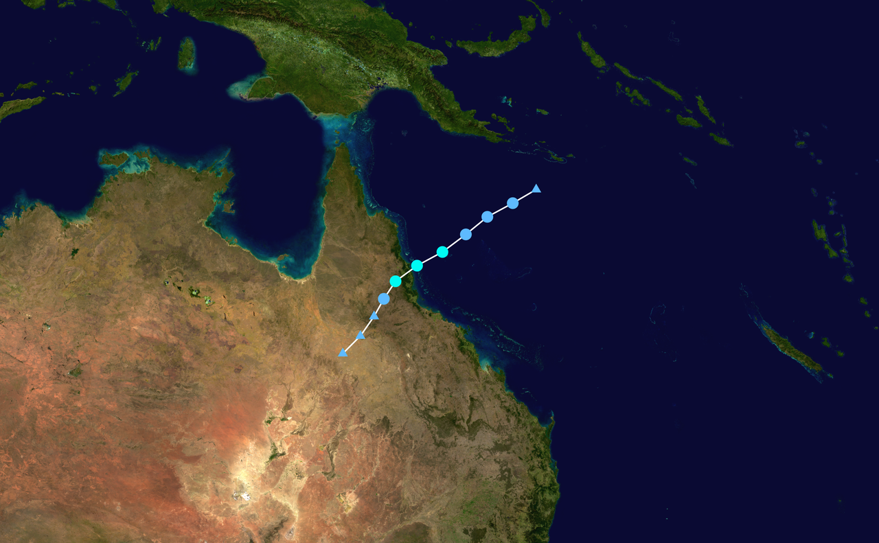
The floods resulted from an unusually strong La Niña pattern that delivered above-average moisture to eastern Australia during 2010. In December a monsoonal trough combined with tropical systems to concentrate rainfall over large catchments. Tropical Cyclone Tasha and associated disturbances merged with surface troughs and produced prolonged downpours that saturated soils and filled river systems across northern and eastern Queensland. December 2010 recorded state rainfall totals well above prior records, and the event was widely described as one of the most significant rainfall episodes for the region in decades. Meteorological summaries and technical discussion can be found via tropical cyclone analyses, trough dynamics and monsoonal activity links such as this summary. Broader basin context is available from regional sea and gulf overviews like Coral Sea and Gulf of Carpentaria reports.
Flood progression and affected infrastructure
Flooding developed in multiple modes: flash floods from extreme short‑term rainfall, larger riverine floods as catchments routed water downstream, and urban inundation where drainage systems were overwhelmed. Many towns experienced repeated flooding as successive rainfall pulses moved through catchments; places such as Condamine and Chinchilla were inundated more than once. Major transport corridors were disrupted with hundreds of road closures and interruptions to rail lines that affected coal and freight movements. Mine sites and industrial areas reported inundation and shutdowns. For local impact descriptions see regional notes including the Gold Coast and other coastal zones via local reports and town-level pages such as Condamine and Chinchilla.
Human impact, emergency response and health risks
The human cost included loss of life, large-scale evacuations and widespread property damage. Authorities declared large areas of Queensland disaster zones, and emergency services—state rescue units, volunteer organisations and the Australian Defence Force—were mobilised for evacuation, sandbagging and relief work. Displaced residents, emergency shelters and ongoing recovery needs placed strain on local services. Floodwater also brought secondary hazards: displaced wildlife such as snakes sought refuge in houses and high ground, while reports of saltwater crocodiles and sharks in some inundated coastal and estuarine towns added to health and safety concerns; see regional wildlife advisories at reptile safety guidance and marine sightings at marine hazard notes.
Economic, environmental and social consequences
Economic impacts were substantial. Agricultural production suffered crop losses and damage to orchards and market gardens, contributing to short‑term rises in fruit and vegetable prices. Transport and mining disruptions affected supply chains and regional employment. Environmental consequences included altered river flows, sediment redistribution and impacts to riparian habitats. Recovery and cleanup required major coordinated efforts across government and community sectors. Summaries of sectoral impacts and recovery programs are available through government and industry portals such as state overviews and interagency reports at city and regional recovery pages.
Aftermath, lessons and flood management
In the aftermath there were reviews of flood warning systems, dam operation protocols and land‑use planning. Several inquiries examined the timing of controlled water releases, emergency communications and the adequacy of flood mapping for urban and rural communities. Long-term responses included investments in improved forecasts, community resilience programs and revisions to planning guidelines for floodplains. For comparative context and continuation of the story in nearby regions see summaries that include impacts in central and western Victoria and the wider national context at regional impacts and further documentation at infrastructure reports and local recovery records. Additional background and archival material can be consulted through meteorological and emergency management sources such as monsoonal trough analyses and broader environmental assessments at Coral Sea summaries and Gulf reports.
- Timeline: principal events between December 2010 and January 2011.
- Geographic extent: widespread across Queensland with effects extending into Victoria.
- Primary drivers: strong La Niña, tropical cyclones and monsoonal trough activity.
- Notable issues: repeated town flooding, transport interruptions, agricultural losses and wildlife hazards.
For more detailed case studies, local histories and archival photographs consult the referenced material and local government recovery pages, or search contemporary journalistic and official reports via the links above.
Questions and answers
Q: What caused the 2010–11 Queensland floods?
A: The floods were caused by heavy rain from tropical cyclone "Tasha" that joined with a trough during a La Niña event. La Niña is an unusual weather pattern, which brings wet weather to eastern Australia. The 2010 La Niña was the strongest since 1973, causing heavy rainfall across Queensland.
Q: How many towns and people were affected in Queensland?
A: At least 70 towns and 200,000 people were affected in Queensland. Three-quarters of the state of Queensland has been declared a disaster zone.
Q: How many people died as a result of the floods?
A: The 2010–2011 floods have killed 35 people across Queensland since November and 14 are still missing. More than 20 people have died in flash floods between Brisbane and Toowoomba.
Q: What other effects did the flooding have on local communities?
A: The floods forced thousands of people to leave their homes, closed 300 roads including nine major highways, flooded Coal railway lines and mine sites, caused fruit and vegetable prices to rise as crops were destroyed, led to an increase in snakes seeking safety on higher ground or in houses with people, allowed saltwater crocodiles and sharks to be seen in some flooded areas of towns.
Q: What records were set due to this event?
A: December 2010 was recorded as the wettest on record for 107 places getting their highest rainfalls ever; it was also recorded as the state's wettest spring since 1900 and Australia's third wettest year overall.
Q: Was there any warning about these extreme weather conditions before they occurred?
A: Yes - warnings had been issued about potential flooding due to unusually strong La Niña conditions bringing wet weather to eastern Australia.
Related articles
Author
AlegsaOnline.com 2010–2011 Queensland floods Leandro Alegsa
URL: https://en.alegsaonline.com/art/112431
Sources
- abc.net.au : "Victoria's flood crisis to continue for days"
- humanappeal.org.au : "Queensland Floods Appeal"
- bbc.co.uk : "Australia: Queensland floods spur more evacuations"
- brisbanetimes.com.au : "Three-quarters of Queensland a disaster zone"
- reg.bom.gov.au : "Queensland in December 2010: The wettest December on record"
- reg.bom.gov.au : "Queensland in spring 2010: The wettest spring"
- earthobservatory.nasa.gov : "Heavy Rains in Queensland"
- news.smh.com.au : "Hundreds of roads closed in flooded Qld"
- theaustralian.com.au : "Some Queensland flood victims facing long wait to return to their flooded homes"
- bbc.co.uk : "Flood-hit Queensland braced for fresh storms"
- brisbanetimes.com.au : "Flooding could last 'weeks, not days'"
- abc.net.au : "Flood destroys doctor's surgery in Theodore"
- brisbanetimes.com.au : "From drought to flooding rains: Queensland's flood crisis continues"