
Zuiderzee Works (Dutch coastal engineering and land reclamation project)
Large 20th-century Dutch engineering programme to close the Zuiderzee, create the IJsselmeer and reclaim polders for flood protection, agriculture and development.
The Zuiderzee Works is a comprehensive Dutch engineering programme of dams, dykes, polders and water‑management structures built to transform the former saltwater inlet known as the Zuiderzee into a safer, more controllable freshwater system. Initiated in the early twentieth century, the works combined large civil-engineering closures with systematic land reclamation and drainage to reduce flood risk, expand agricultural land and reshape coastal ecosystems.
Image gallery
10 Images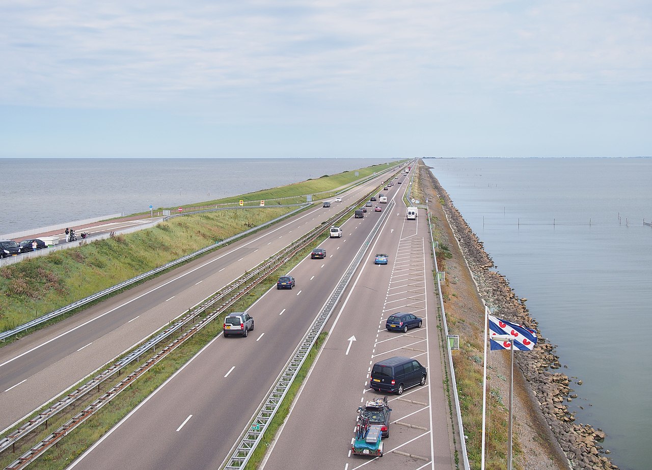



Scope and principal components
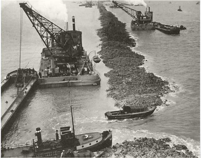
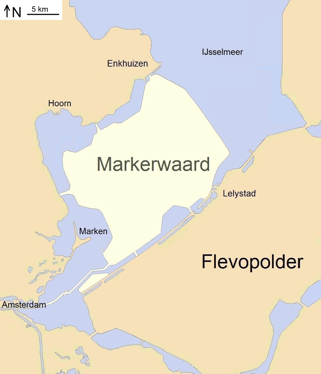
The project combined several building blocks: long closure dams, ring dikes around new polders, pumping stations, and controlled outlets that balance lake level and navigation. The most prominent single structure is the Afsluitdijk, a 32‑kilometre closure that separated the former inlet from the North Sea and created the freshwater IJsselmeer. The programme also created a series of polders—tracts of reclaimed land—by constructing enclosing dikes and removing water with pumps, turning shallow sea or marsh into productive land.
- Major civil works: long dams and dykes to block tidal flow and protect inland areas.
- Land reclamation: systematic land reclamation by building ring dikes and dewatering basins to produce polders.
- Hydraulic control: sluices, locks and pumping systems for water management, to evacuate excess water and maintain navigable depths for shipping.
History and development
Ideas to alter or reclaim the Zuiderzee date back centuries, but decisive action followed severe events in the twentieth century. A major storm surge in 1916 galvanized public and political support and led to legislation and funding for a comprehensive programme. The Dutch government and engineers then pursued stages of construction over several decades: first the construction of the Afsluitdijk that partitioned the former sea from the North Sea and created the IJsselmeer, then sequential polder projects that expanded usable land and improved flood resilience.
Engineering features and operations
Work began with sealing the mouth of the inlet and installing mechanical systems to control water inflow and outflow. The closure contains navigation passages and hydraulic devices: locks allow vessels to transit while sluices and pumping stations discharge river inflow and rainwater from the polders. The continual balance between river inputs, rainfall, and managed releases keeps the lake and reclaimed land at safe levels. The programme required sequential construction: dike building, dewatering, soil improvement and infrastructure for transport and settlement.
Uses, benefits and impacts
The works dramatically increased flood protection for large parts of the Netherlands, provided new agricultural land, and enabled planned urban development on reclaimed polders. Reclaimed areas delivered fertile soils for intensive farming and space for towns and transport corridors. At the same time, converting a tidal salt inlet into the freshwater IJsselmeer changed fisheries, ecosystems and sediment dynamics. New freshwater habitats replaced many marine ones, and long‑term ecological management has been required to balance nature conservation with human use.
Legal, social and notable facts
The programme was enacted through national policy and parliamentary approval; public concern after the 1916 flood helped secure legislative backing. The comprehensive approach merged civil engineering with land‑use planning, and the Zuiderzee Works have been widely cited as an example of large‑scale human reshaping of a coastline. They remain an influential case in engineering history and coastal management, often cited when discussing resilience, reclamation and the trade‑offs between protection and environmental change.
For further technical descriptions and historical background consult summaries of twentieth‑century Dutch hydraulic engineering, archival material on the Afsluitdijk and polders, and contemporary resources on water management and coastal adaptation. The project demonstrates how targeted infrastructure—dams, polders and controlled outlets—can transform risk landscapes and create new economic and ecological templates for a low‑lying country.
twentieth century context • 1916 flood • Dutch engineering tradition • parliamentary approval • Zuiderzee name • pumping and dewatering
Questions and answers
Q: What are the Zuiderzeewerken?
A: The Zuiderzeewerken are a system of dams, land reclamation and water drainage works in the Netherlands during the twentieth century.
Q: When did plans for the works first begin?
A: Plans for the works date back to the 1600s.
Q: What event finally caused Dutch parliament to agree to pay for them?
A: A very bad flood in 1916 finally caused Dutch parliament to agree to pay for them.
Q: What is the biggest dam built as part of this project?
A: The biggest dam built as part of this project is called the Afsluitdijk ('closure dyke'), which is 32 kilometres (19.9 mi) long.
Q: How did cutting off the South Sea create a new body of water?
A: When it was finished in 1932, cutting off the South Sea created a new lake called IJsselmeer.
Q: How does land reclamation work?
A: Land reclamation involves building more dams and pumping out any water inside so that new land can be created for agriculture and better flood protection since it makes the lake smaller.
Q: What purpose do gates and sluices serve at either end of Afsluitdijk?
A: Gates and sluices at either end of Afsluitdijk serve two purposes - they allow ships through via locks, while also allowing water out via sluices so that flooding doesn't occur due to rivers and polders being drained into it.
Related articles
Author
AlegsaOnline.com Zuiderzee Works (Dutch coastal engineering and land reclamation project) Leandro Alegsa
URL: https://en.alegsaonline.com/art/110754