Zakynthos (Zante): Greek Ionian Island — geography, history, and attractions
Zakynthos (Zante) is a Greek island in the Ionian Sea known for its beaches, marine life and historic towns. This article summarizes its geography, history, natural features, main sights and visitor information.
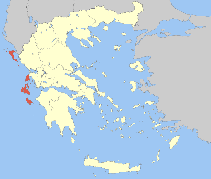
Zakynthos, often called Zante in English, is a Greek island in the Ionian Sea. Located off the west coast of the Peloponnese, it ranks among the larger Ionian islands and is known for a mix of lowland plains and hills to the north. The resident population is roughly 41,000. The island's principal urban centre is Zakynthos city, which functions as the administrative and commercial hub for the island's residents and visitors. For general maps and location details see Zakynthos on an island overview.
Image gallery
10 Images


Geography and landscape
Zakynthos covers a largely flat area with small mountains and rolling hills in the northern parts. The coastline features long sandy beaches, dramatic cliffs and sheltered bays. Coastal geology includes limestone formations and sea caves; the famous Blue Caves lie along the northern shore. The island's mild Mediterranean climate supports olive groves, vineyards and citrus orchards inland. For regional context within the Ionian group consult Ionian islands information.
History and cultural notes
The island has a layered history shaped by Greek, Byzantine and Western Mediterranean influences, including periods under Venetian and British administration before union with modern Greece. This diverse past appears in local architecture, music and cuisine. Traditional festivals, religious processions and folk music remain important to community life in towns and villages.
Wildlife and environment
Zakynthos is notable for its marine biodiversity. Beaches on the island are important nesting sites for the loggerhead sea turtle (Caretta caretta), a conservation focus and draw for responsible eco-tourism. Coastal waters host seagrass beds and varied marine fauna. Parts of the island are subject to environmental protections to safeguard nesting beaches and marine habitats.
Main attractions and visitor highlights
- Navagio (Shipwreck) Beach: a sheltered cove with a rusting wreck and steep white cliffs.
- The Blue Caves: sea caves prized for iridescent water and boat access.
- Zakynthos city: historic centre, waterfront promenade and local markets — see city guide.
- Wildlife viewing: turtle nesting beaches and boat trips to marine areas.
Travel to and around the island is commonly by ferry and regional flights to nearby hubs, with road connections linking villages and beaches. Practical visitor advice, conservation guidelines and transport schedules can be found through regional tourism resources at local transport and tourism. Zakynthos combines natural scenery, cultural heritage and beach recreation, making it a prominent destination in the Ionian Sea and a focus for both leisure travel and environmental stewardship.


Geography, geology and climate
Geography
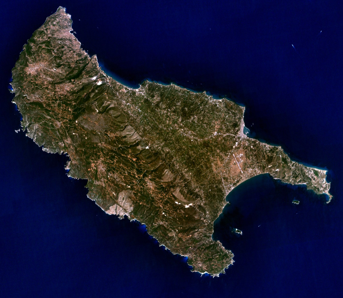
Zakynthos is the southernmost of the larger Ionian Islands. The island has an area of 406.619 km² and is maximum 40 km long and 20 km wide. The longitudinal axis of the island runs from northwest to southeast. Its northernmost point is Cape Skinari, and its southernmost point is Cape Marathia on the peninsula of the same name. The westernmost point of the island is Cape Plemonari, the easternmost Cape Vasilikos on the Skopos peninsula. Zakynthos lies approximately at the latitude of the Greek capital Athens.
The island is roughly divided by two different landscapes: According to the longitudinal axis of the island from northwest to southeast runs in the west and north of the island a mountain massif, the highest point of which is the mountain Vrachionas with a height of 756 m. Correspondingly, the coast of the island falls steeply in its entire western course with a height of up to 200 m to the Ionian Sea. East of the mountain massif, a larger plain extends to the east and southeast, which has only isolated hills near the coast. In the south of the island, the approximately crescent-shaped bay of Laganas (Kolpos Lagana) forms a north-facing incision in the island's land mass. The Bay of Laganas is bordered on the west and east by two peninsulas. To the west, the Marathia Peninsula (or Keri Peninsula) delimits the Bay of Laganas from the open Ionian Sea to the west. The peninsula is hilly and reaches 416 m above sea level at its highest point, Mount Kakavakia. The second highest peak, Skopos, is 3 m lower. The coasts of the peninsula of Marathia are cliffs, except for a few places at the bay of Laganas. The eastern limit of the bay of Laganas is formed by the Skopos peninsula, which delimits the bay of Laganas against the strait of the Zakynthos channel. The highest point of the peninsula is the mountain (or hill) Skopos with a height of 491 m. Mount Skopos is located in the transition between the Skopos peninsula and the island plain southeast of the island capital Zakynthos. To the southeast, the Skopos peninsula flattens out and runs out in Cape Gerakas. Accordingly, shallow coastal profiles are found mainly on the eastern side of the peninsula, while on the western side shallow and steep coastal profiles alternate.
Zakynthos includes several small islands within 2 km of the island's coast: to the west of the island, off Porto Vromi Bay, is the uninhabited island of Agios Ioannis, and to the northeast of the island, off Agios Nikolaos, is the uninhabited island of the same name. In the bay of Laganas (Kolpos Lagana), located in the south of the island, there are three islands: The largest island Marathonisi is located in the west of the bay east of Cape Marathia. The second largest island Kalonisi (Pelouzo) is located in the east of the bay west of the Skopos peninsula and south of Dafni beach. The third largest island, Agios Sostis, is just under 100 metres offshore from the port of Agios Sostis and is connected to it by a footbridge southwest of the village of Laganas. All three islands are uninhabited, with Agios Sostis being used as a bar and disco. Both Marathonisi and Agios Sostis are privately owned.
North of Zakynthos lies the largest Ionian island Kefalonia. The shortest distance between the northern tip of Zakynthos (Cape Skinari) and Kefalonia is 15 km. East of Zakynthos lies the northwestern tip of the Peloponnese, Cape Kyllini. The portion of the Ionian Sea between the northwest coast of the Peloponnese and the east coast of Zakynthos is called the Zakynthos Channel: it is 9.5 km wide at its narrowest point. To the west, the nearest land mass is southern Italy and Sicily. About 35 km south of Zakynthos is the archipelago of the Strofades.
Athens is located about 300 km east of Zakynthos, Thessaloniki about 500 km northeast, Patras about 70 km east-northeast.
Geology
Zakynthos is one of the most earthquake-prone areas in Greece. According to the four-level earthquake risk classification of Greece (based on the probability of severe earthquakes, where I means low probability and IV means very high probability), Zakynthos belongs to zone IV according to the classification according to the 2003 Earthquake Protection Laws of Greece (for comparison: Florina II, Athens III, Thessaloniki III, Corinth IV, Syros I, Naxos I). Severe earthquakes with large property damage as well as injuries and fatalities have been repeatedly described for Zakynthos. The last severe earthquake with human casualties and considerable destruction on the island occurred on August 12, 1953. Earthquakes with tsunamis have also been described, for example in an earthquake on December 3, 1898. Landscape changes have also been caused by earthquakes in Zakynthos in the last one thousand years: An earthquake with a tsunami led to considerable flooding on November 5, 1633 and to the separation of the present small island of Agios Sostis southwest of Laganas from Cape Agios Sostis and thus from the mainland.
The reason for this earthquake frequency is the location of Zakynthos on the so-called Hellenic trench, which runs west of the island from northwest to southeast. The Hellenic trench is formed by the collision between the Eurasian and African continental plates. The latter forms a large part of the floor of the Ionian Sea between Sicily and southern Italy to the west and the Ionian Islands and mainland Greece to the east. Both the Greek mainland and the Ionian islands, including Zakynthos, lie on the Eurasian continental plate. Due to the tensions between the colliding continental plates, earthquakes occur repeatedly. Another consequence of the plate collision is the Hellenic Trench as a depression of the earth's crust, which reaches depths of more than 4,000 m in the Ionian Sea west, southwest and south of Zakynthos and is one of the deepest parts of the Mediterranean Sea.
Climate
Zakynthos is located in the Mediterranean climate zone and thus has precipitation mainly in the winter half of the year. However, the annual rainfall is quite high, resulting in lush vegetation. This precipitation occurs in winter when the air over the warm Ionian Sea becomes saturated with moisture and the clouds then move from west to east along the west coast of Greece and thus also in Zakynthos, where they first hit land and rain down.
| Monthly average temperatures, sunshine hours, rainy days and water temperatures for Zakynthos
Source: missing | ||||||||||||||||||||||||||||||||||||||||||||||||||||||||||||||||||||||||||||||||||||||||||||||||||||||||||||||||||||||||||||||||||||||||||||||||||||||||||||||||||||||||||||||||||||||||||||||||||||||||||||||||||||||||||||||
Fauna
The endangered loggerhead turtle (Caretta caretta) uses the beaches in the south of the island along Laganas Bay as a nesting area. The beaches used as nesting areas have a total length of 5.5 km with widths ranging from 10 to 60 m; the longest nesting beach is 2.7 km long. Between 857 and 2018 loggerhead turtle egg-layings are counted per year. From the beginning of June, the females come to the southern beaches to bury their eggs in the sand at night. The incubation period is about 55 days. The hatched young immediately make their way to the open sea. It is very important to protect the clutches as the survival rate of the young is very low. One to two turtles make it out of about 1000 eggs. If a nest is found in a vulnerable area (beach entrance for example), it is protected with a grid. To protect these turtles, motorized water sports are not allowed on some beaches. Likewise, some beaches have fencing to prevent parasols and the like from destroying the eggs. In order not to disturb the animals when they lay their eggs at night, a part of the beach is completely closed from 19:00.
![]()
Parts of this article appear to be out of date since 2009.
Please help to research and insert the missing information.
Wikipedia:WikiProject Events/Past/2009
With the help of the environmental organization "Earth, Sea and Sky", a new turtle rescue station is to be completed in spring 2009.
Dolphins live in the surrounding coastal waters of the island. For the terrestrial fauna see Kühnelt 1941.

Questions and answers
Q: What is Zakynthos?
A: Zakynthos is a Greek island.
Q: Where is Zakynthos located?
A: Zakynthos is located in the south Ionian Sea, west of the Peloponnese.
Q: What is the population of Zakynthos?
A: The total population of Zakynthos is 41,472 inhabitants.
Q: Which is the largest town in Zakynthos?
A: The largest town in Zakynthos is Zakynthos city.
Q: Is Zakynthos a hilly island?
A: Part of Zakynthos is hilly. To the north of the island, there are low mountains and hills.
Q: What is the total area of Zakynthos?
A: The total area of Zakynthos is 410 square kilometres.
Q: In which sea is Zakynthos located?
A: Zakynthos is located in the Ionian Sea.
Related articles
Author
AlegsaOnline.com Zakynthos (Zante): Greek Ionian Island — geography, history, and attractions Leandro Alegsa
URL: https://en.alegsaonline.com/art/110355
Sources
- news.bbc.co.uk : BBC, English tourists in Zakynthos
- trekearth.com : The shipwreck beach in Zakynthos