
Zakarpattia Oblast (Transcarpathia): geography, history, people and economy
Zakarpattia Oblast (Transcarpathia) is Ukraine's westernmost region in the Carpathians, centered on Uzhhorod. It is multiethnic, historically contested, and important for cross‑border trade and mountain tourism.
Zakarpattia Oblast is a distinct administrative region in western Ukraine centered on the city of Uzhhorod. The region is known by several names and in several languages: Ukrainian Закарпатська область (transliteration Zakarpats’ka oblast’), Rusyn Подкарпатьска област, Hungarian Kárpátontúli terület, and Slovak Zakarpatská oblasť. Administratively it functions as an oblast (a province) within the Ukrainian state. Its modern territorial status was fixed after World War II and the incorporation of Subcarpathian lands into the Ukrainian Soviet Socialist Republic.
Image gallery
10 Images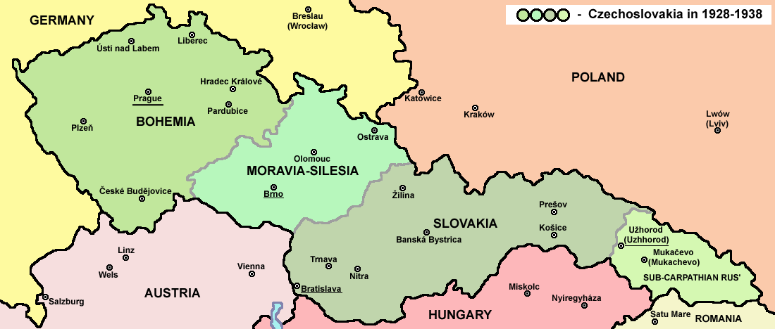



Geography and natural features
Zakarpattia occupies a predominantly mountainous and foothill zone formed by the Carpathian Mountains. Valleys carved by rivers and broad passes link the region to neighboring states. It is the only Ukrainian province that borders four countries at the same time: Poland, Slovakia, Hungary and Romania. The highlands give rise to forestry, pasture and mineral springs; scenic landscapes have supported a long tradition of spas and mountain recreation.
Major towns and transport
Besides the administrative center Uzhhorod, important urban centres include Mukachevo, Khust, Berehove and Chop. Chop is a strategic rail and highway gateway near a major border crossing. The region's transport function is tied to trans‑European corridors and cross‑border freight movements, while local roads and railway lines connect mountain communities to the plains.
- Uzhhorod — regional capital and cultural hub
- Mukachevo — historic castle and market town
- Berehove — center of winegrowing and Hungarian‑language culture
- Khust — regional service and trade center
- Chop — international rail and border junction
Zakarpattia's climate and soils support mixed agriculture in lower valleys and horticulture including vineyards around Berehove. Mountain slopes serve forestry and meadow pastoralism, and mineral springs and ski areas make the oblast one of Ukraine's better known domestic tourist destinations. Cross‑border trade and small manufacturing also contribute to the local economy.
History, identity and population
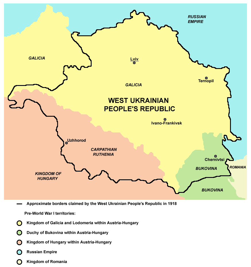
The territory now called Zakarpattia has a complex modern history: it was part of the Austro‑Hungarian realm, later became a region of interwar Czechoslovakia (often called Subcarpathian Rus'), experienced wartime shifts, and after 1945 was integrated into the Soviet Ukrainian republic—formally reconstituted in January (January 22) 1946. In the 1991 independence period a special option on regional autonomy appeared on local ballots; opinions on autonomy and regional identity have remained diverse.
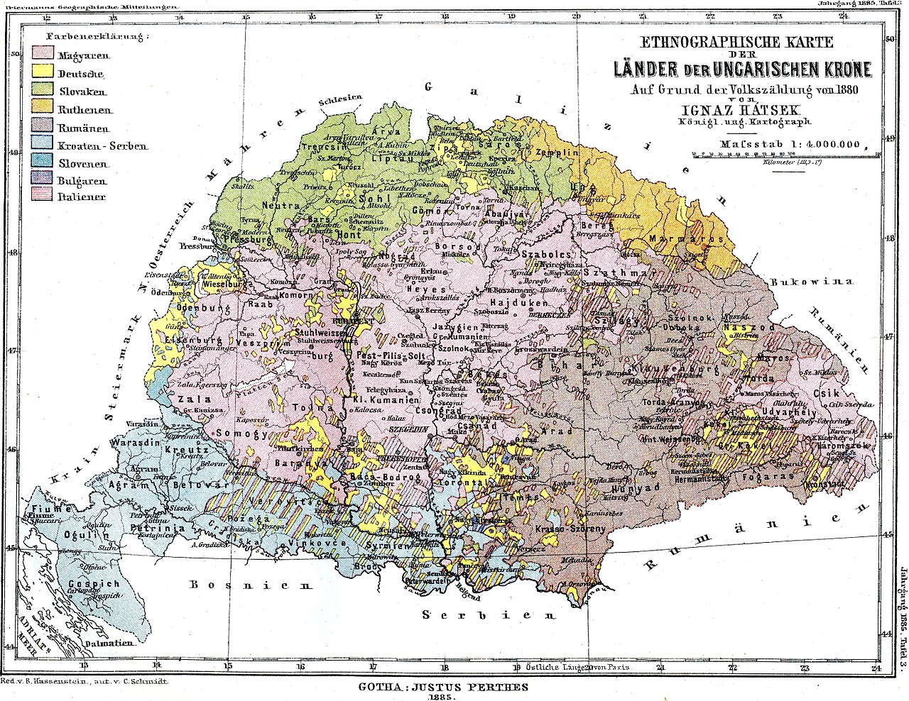
The oblast is ethnically varied. Ethnic Ukrainians are a plurality, and sizable Hungarian, Romanian, Rusyn and Slovak communities live in the region. Language use, minority rights and cultural institutions reflect that diversity; Hungarian and other minority languages are important in local life, especially in borderland towns.
Administration and contemporary notes
Administratively the oblast is divided into local raions and municipalities; nationwide administrative reforms in recent years reorganized local districts to improve governance. Zakarpattia's frontiers and multiethnic character make it important for international cooperation, minority affairs and mountain conservation. Its blend of border commerce, cultural variety and natural attractions gives the region a distinctive place in the geography of Central and Eastern Europe.
For readers seeking further reference material on names, administrative history and demographics, see local government publications and regional studies that document Zakarpattia's layered past and its contemporary role as a crossroads between nations and landscapes.
Questions and answers
Q: What is the administrative center of Zakarpattia Oblast?
A: The administrative center of Zakarpattia Oblast is the city of Uzhhorod.
Q: What other major cities are located in the oblast?
A: Other major cities located in Zakarpattia Oblast include Mukachevo, Khust, Berehove and Chop.
Q: When was Zakarpattia Oblast formally established?
A: Zakarpattia Oblast was formally established on January 22, 1946 after the incorporation of Subcarpathian Rus lands to the Ukrainian Soviet Socialist Republic.
Q: How many countries does it border?
A: Zakarpattia Oblast borders four countries - Poland, Slovakia, Hungary and Romania.
Q: What role do the Carpathian Mountains play in its economy?
A: The Carpathian Mountains play a major part in the oblast's economy, making it an important tourist and travel destination housing many ski and spa resorts.
Q: Where does it rank by area and population?
A: By area, Zakarpattia Oblast ranks 23rd; by population it ranks 17th.
Q: What is the total population according to 2001 Ukrainian Census?
A: According to 2001 Ukrainian Census, the total population of Zakarpattia Oblast is 1,254,614 people.
Related articles
Author
AlegsaOnline.com Zakarpattia Oblast (Transcarpathia): geography, history, people and economy Leandro Alegsa
URL: https://en.alegsaonline.com/art/110350
Sources
- carpathia.gov.ua : "Geography"
- kmu.gov.ua : "Zakarpattya Region"
- all.zakarpattya.net : "Transcarpathia is my region"
- whc.unesco.org : "Primeval Beech Forests of the Carpathians"
- ukranews.com : "Svoboda Party Calls On SBU To Launch Criminal Case Against Delegates To Congress Of Carpathian Ruthenians For Declaring Carpathian Ruthenia Republic"
- jamestown.org : Is Yushchenko’s Top Aide Backing Ruthenian Separatist Movement?
- ukranews.com : "Prosecutors File Case Against People Who Initiated Proclamation Of Carpathian Ruthenian Republic On Separatism Charges"
- podrobnosti.ua : "Mikhail Kichkovsky is elected Chairman of the Zakarpattia oblast council"
- gska2.rada.gov.ua : "General info. Zakarpattia Oblast"
- gska2.rada.gov.ua : "Zakarpattia Oblast (raions)"
- gska2.rada.gov.ua : "Zakarpattia Oblast (villages)"
- gska2.rada.gov.ua : "Zakarpattia Oblast (urban-type settlements)"
- gska2.rada.gov.ua : "Zakarpattia Oblast (cities of oblast' subordinance)"
- gska2.rada.gov.ua : "Zakarpattia Oblast (cities of raion subordinance)"