
Yellow River (Huang He)
Major river of northern China, noted for heavy silt, historical floods, role in early Chinese civilization, and contemporary water management and environmental challenges.
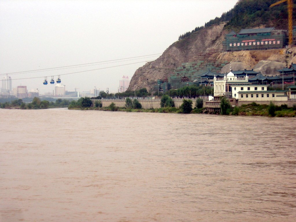
The Yellow River (Huang He, 黄河) is a principal river of northern China and a defining feature of East Asian geography. It is often described as the cradle of Chinese civilization because early agricultural societies developed along its fertile floodplains. Measured at roughly 5,464 km, it is the second longest river in China and one of the world's longest rivers. The river empties into the Bohai Sea, a gulf of the Yellow Sea, and has a distinct yellowish color caused by the fine windblown silt carried from the Loess Plateau.
Image gallery
10 Images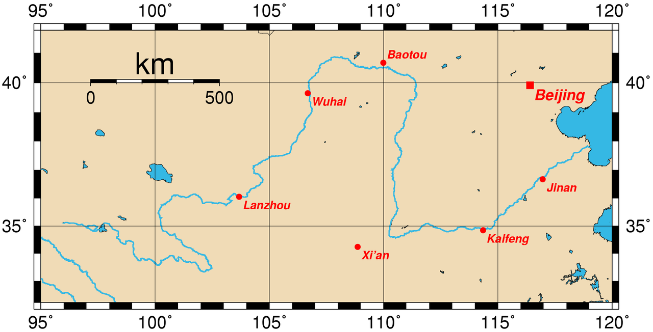


Physical characteristics
The Yellow River's basin includes a wide variety of landscapes: high mountain headwaters, the broad Loess Plateau where intense erosion supplies vast quantities of sediment, and lower alluvial plains. Its suspended sediment load is among the highest of any large river, which gives the water its characteristic hue and contributes to rapid channel aggradation. Over centuries the buildup of silt has required extensive dikes and levees to protect farmland and towns.
Course and basin
The river rises in the Bayan Har Mountains on the Tibetan Plateau, flows eastward across several provinces, and discharges into the Bohai Sea. Its watershed supports tens of millions of people through irrigation, industry, and urban centers. Historically the river's lower reaches have shifted course episodically, sometimes dramatically altering the landscape and affecting settlements.
History and cultural importance
The Yellow River is widely known in China as the "Mother River" and is associated with the origins of Chinese statehood and early farming cultures. It appears in myth and literature; in traditional belief the river is personified by the deity Hebo. Its repeated floods have been central to Chinese history, shaping political responses, engineering traditions, and social organization.
Uses, management, and challenges
- Uses: irrigation, municipal and industrial water supply, some hydroelectric power, and navigation in parts of the basin.
- Management: centuries of flood control works, modern dams and reservoirs, and coordinated basin management efforts aim to balance water use with safety.
- Challenges: sedimentation, seasonal variability, upstream water withdrawals, pollution, and periodic sections that have run dry in drought years.
Notable facts and further reading
As a geographical and cultural landmark the Yellow River is both celebrated and feared for its power. It remains a subject of ongoing research and policy focus, from archaeological studies of early civilizations to modern hydrology and environmental restoration. For comparisons with other rivers see the discussion of river length and ranking in China and globally at Chinese river rankings and for broader continental context consult resources about the Yangtze at Yangtze River. For information on the Bohai and Yellow Seas where the river discharges, see regional marine studies at Bohai Sea resources.
Source
The source of the Yellow River is located in the vast expanses of the highlands of Tibet, framed by relatively flat-looking mountains, about 200 kilometers north of the midpoint as the crow flies between Lhasa, the capital of the Tibet Autonomous Region, and Xining in the Tibetan-majority Amdo region. There it is located in the Bayankara Shan mountain range (south of Kunlun Shan) about 450 kilometers east of the headwaters of the Yangtze River, west of two lakes (Ngoring Tsho and Kyaring Tsho) and northwest of the Sea of Stars (Xingsuhai) - a rocky steppe-like area.
River
From its source, the Yellow River first crosses the two lakes Gyaring Tsho (Tsaring-nor) and Ngoring Tsho (Ngoring-nor) (34° 55′ 19″ N, 97° 30′ 43″ E34.921966666797.5119). It then flows mainly eastward under the Tibetan name Ma-chu (Tib. རྨ་ཆུ་, "River of the Peacock"; Chinese 瑪曲 / 玛曲, Mǎqū) in a zigzag course through a strongly winding high mountain valley, not far from the sacred mountain A'nyê Maqên.
Its further course then leads northwards, where it advances to the borders of Inner Mongolia. There it describes a huge arc around the Ordos Plateau until, now flowing south again, it flows into the reservoir of the Sanmenxia Dam. In this lake, the Wei He flows into it from the region of the ancient imperial city of Xi'an; this is the largest tributary of the Yellow River.
North of the Funiushan Mountains, it turns 90° to the east. From there, the Yellow River flows consistently eastward across the Xiaolangdi Dam, crossing a loess plateau in Shaanxi and Shanxi provinces and gradually leaving the gorge-rich mountainous region.
About 45 km after the city of Kaifeng, the river turns northeast and flows through the lowland formed by its sediments. Just over 500 km beyond Kaifeng, the Huáng Hé reaches the Gulf of Bohai, a marginal area of the Yellow Sea, between Tianjin and the Shandong Peninsula.


Related articles
Author
AlegsaOnline.com Yellow River (Huang He) Leandro Alegsa
URL: https://en.alegsaonline.com/art/109771