Wiltz (river)
The Wiltz is a river in Belgium and Luxembourg, a left tributary of the Sauer (Sûre) and part of the Rhine drainage system. It flows through the town of Wiltz and shapes a rural valley with ecological and historical value.
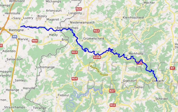
The Wiltz is a small cross-border river that runs through parts of Belgium and northern Luxembourg. It is a left tributary of the Sauer (Sûre) and ultimately drains into the Rhine basin. The river's position is commonly referenced at coordinates 49°55′25″N 6°02′58″E.
Image gallery
4 Images


Course and geography
The Wiltz rises in the wooded uplands of the Ardennes in Belgium and crosses the border into Luxembourg, where it flows through a narrow valley carved into local sandstone and shales. Along its route the river passes the town that shares its name and other small settlements before joining the Sauer downstream. Its confluence with the larger river is part of the network feeding the Rhine (drainage basin).
Characteristics
The Wiltz is a typical small European valley river: seasonal flow variation, clear stretches alternating with pools, and a gravelly or rocky bed in places. It functions as a left-bank feeder to the Sauer (Sauer), and is identified in maps and guides as a significant tributary (left tributary) of that system.
Human use and history
Settlements along the Wiltz have historically used the river for water supply, small-scale milling and textile-related operations, and more recently for local recreation. The town of Wiltz developed industries and infrastructure that relied on the river valley for power, transport of goods, and waste removal in earlier centuries.
Ecology and management
The Wiltz valley supports riparian vegetation, aquatic invertebrates and fish species typical of central European streams. Local authorities and conservation groups monitor water quality, manage flood risk, and maintain banks for biodiversity and safe recreational use.
Notable facts
- The Wiltz connects two countries across a short international course.
- It is part of the larger Rhine river network via the Sauer (Sauer) and related waterways (Rhine basin).
- Coordinates and mapping references are commonly provided for navigation and study (location).
For regional information and maps, consult country and river resources specific to Belgium and Luxembourg, and hydrological summaries of the Rhine watershed. Further local details are available through municipal guides and river surveys (river data).
Questions and answers
Q: What is the Wiltz?
A: The Wiltz is a river in Belgium and Luxembourg.
Q: What are the coordinates of the Wiltz river?
A: The coordinates of the Wiltz river are 49°55′25″N 6°02′58″E.
Q: What is the Wiltz's direction of flow?
A: The text does not provide information about the Wiltz's direction of flow.
Q: Is the Wiltz a left or right tributary of the Sauer river?
A: The Wiltz is a left tributary of the Sauer river.
Q: What is the Wiltz's relationship to the drainage basin of the Rhine river?
A: The Wiltz is part of the drainage basin of the Rhine river.
Q: Where is the Wiltz located?
A: The Wiltz is located in Belgium and Luxembourg.
Q: Is the Wiltz the only river that is a tributary of the Sauer river?
A: The text does not provide information about whether the Wiltz is the only river that is a tributary of the Sauer river.
Related articles
Author
AlegsaOnline.com Wiltz (river) Leandro Alegsa
URL: https://en.alegsaonline.com/art/108426