Wesel — city on the Rhine in North Rhine-Westphalia
Wesel is a German city of about 60,000 in North Rhine-Westphalia. Located at the Rhine and Lippe, it has medieval origins, a history as a fortified river port, and modern transport and industry.
Wesel is a mid-sized German city in the state of North Rhine-Westphalia. It lies in the lower Rhine region near the industrial Ruhr area and is close to the city of Duisburg. Today Wesel has a population of roughly sixty thousand and serves as an administrative and economic centre for its surrounding district (Wesel district).
Image gallery
6 Images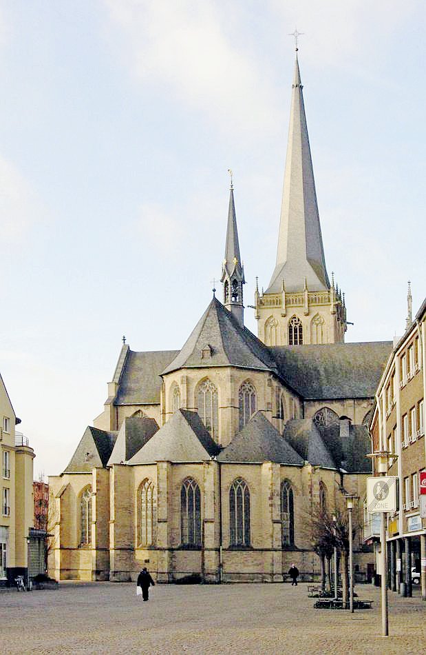


Geography and environment
The town sits at the meeting area of the Rhine and the Lippe rivers, a location that shaped its development as a river port and trading place. Its position on the lower Rhine gives it a generally flat landscape with riverbanks, small floodplain woodlands and agricultural land nearby. The city forms part of the broader Lower Rhine cultural landscape and is connected by regional road and rail routes to nearby urban centres and the Ruhr area.
History and development
Wesel has medieval origins and received town privileges during the 13th century (dates such as 1241 are commonly cited in local records). Over the centuries it developed as a fortified town and trading hub because of its river access. Like many towns on the lower Rhine, Wesel suffered extensive damage in the Second World War and underwent substantial rebuilding during the postwar period, which shaped much of the modern urban fabric.
Economy, transport and uses
Historically important as a river port, Wesel remains oriented toward transport, logistics and medium-sized industry. Its inland port and connections to regional rail lines and highways support freight movement across the Rhine corridor. The city is also a local service and administrative centre, with cultural institutions, schools and municipal services serving the surrounding towns and villages.
Places of interest and civic life
- Historic market areas and rebuilt town centre reflecting postwar reconstruction.
- Riverside promenades and parks along the Rhine and Lippe.
- Local museums and exhibitions that present the town’s regional history and river heritage.
For further practical information about the region around Wesel and administrative matters see regional resources, for example pages on Lower Rhine topics and the Wesel district administration. Wesel’s riverside setting, medieval roots and postwar renewal together make it a representative example of Lower Rhine towns that combine transport importance with local cultural identity.


Geography
Location and extent
Wesel is located on the lower Lower Rhine and is surrounded by various landscapes and cultural areas. On the one hand, the city lies on the edge of the Ruhr area, is a member of the Ruhr Regional Association and is about 25 kilometres away as the crow flies from the city centres of the major cities of Duisburg and Oberhausen to the south. Düsseldorf is about 50 kilometres and Cologne about 85 kilometres to the south. In contrast, the comparatively sparsely populated landscape of the Lower Rhine lies to the north and west beyond the Rhine, and the border to the Netherlands is about 25 kilometres away as the crow flies. To the east and north-east of the city lies the Hohe Mark-Westmünsterland Nature Park, and at the same time the border to the state of Westphalia is located there. The Lippe, which flows into the Rhine there, and also the Issel flow into Wesel.
The urban area covers an area of 122.56 square kilometres, making Wesel the second largest town in the district after Hamminkeln. The maximum north-south extension is 12.0 and the maximum east-west extension is 17.3 kilometres. Since the territorial reform, Wesel with the district of Büderich includes, in addition to its core area on the right bank of the Rhine, an area on the left bank of the Rhine with a surface area of 24 square kilometres. This makes Wesel the town furthest down the Rhine, encompassing areas on both sides of the river. The population density is just under 500 inhabitants per square kilometre, but it is distributed very differently. The most densely populated district of Wesel has almost 1,500 inhabitants per square kilometre, whereas the district of Bislich has only about 70 inhabitants per square kilometre.
In the northwest, Wesel with its district Bislich borders on the area of the city of Rees, also located on the Rhine, which is the only neighboring municipality not belonging to the district of Wesel, but to the district of Kleve. In the north the city area borders on the city Hamminkeln and in the north as well as in the east on the municipality Hünxe. These are both comparatively sparsely populated communities with less than 200 inhabitants per square kilometre. In the south, the Wesel-Datteln Canal forms the border to the town of Voerde. In this direction Wesel is connected to the conurbation of the Ruhr area. In the southwest there is a border to the city of Rheinberg on the left side of the Rhine. To the west there is a land border (district Büderich) as well as a border marked by the Rhine (district Bislich on the right side of the Rhine) to the town Xanten on the left side of the Rhine. The total length of the city border is 61.8 kilometres.
Land use
In 2016, almost half of the urban area was taken up by agricultural land, making it the largest share of the various forms of land use. The share of buildings and open space in the urban area is almost the same as the national average, whereas business, recreational and transport space are all slightly above the national average. Overall, the total share of residential and transport land in the urban area is 24.6 %, slightly above the state average of 22.9 %. This is the sum of the aforementioned types of land, which is, however, calculated in a slightly different way. The share of forest land was significantly lower than the national average in 2016. However, at 14.6 %, the share of forest was only slightly below the average for the Düsseldorf administrative district (15.6 %). At the beginning of 2016, Wesel was the municipality with the largest share of water area among all municipalities in the state of North Rhine-Westphalia. This was 13.3 %, compared to only 1.9 % for the state average. In addition to the Rhine, which is several hundred metres wide, and the rivers Lippe and Issel, larger water areas include several quarry lakes, including the Auesee and the Diersfordter Waldsee. Except for the Auesee, which is very close to the city, all the larger quarry ponds are located in the area of the district Bislich and to a lesser extent in the district Büderich. The neighbouring towns of Rees (12.4 %) and Xanten (11.4 %) also had more than 10 % water areas in 2016.
City breakdown
| Wesel districts | ||||
| Name | Area in km² | Inhabitants | population per km² | Coat of arms |
| Wesel | 26,08 | 38.300 | 1.469 |
|
| Flüren | 9,15 | 4.792 | 524 |
|
| Obrighoven-Lackhausen | 26,79 | 11.026 | 412 |
|
| Bislich | 36,53 | 2.560 | 70 |
|
| Büderich | 24,00 | 5.823 | 243 |
|
| Total | 122,55 | 62.501 | 510 | |
Spatially, the city is divided into the following five districts, which in turn consist of other districts:
- Bislich: Bergerfurth, Bislich and Diersfordt
- Büderich: Büderich, Ginderich and Werrich/Perrich
- Flüren: Flüren
- Obrighoven-Lackhausen: Lackhausen, Obrighoven and Wittenberg
- Wesel: old town, Blumenkamp, Feldmark, Fusternberg and Schepersfeld
For data also about the individual districts see list of the districts of Wesel.
The subdivision into city and town districts primarily serves statistical purposes, but reflects certain historical circumstances. With the exception of Blumenkamp in the north and Lippedorf in the south, the district of Wesel comprises areas that already belonged to the city in the Middle Ages. The development of the Feldmark, Fusternbergs and Schepersfelds into urban quarters started only around 1890. The districts Obrighoven-Lackhausen and Flüren were both incorporated in 1969, but they were already closely connected to Wesel in their historical development and have a population density close to the average of the whole city area. Bislich and Büderich, on the other hand, were only incorporated in 1975 and have a lower population density and more rural structures.


Politics
City Council
Local elections 2020
Voter turnout: 50.7 % (2014: 50.0 %)
%
40
30
20
10
0
34,3 %
33,9 %
14,7 %
5,5 %
5,0 %
4,0 %
2,7 %
none %
gains and losses
The 50 seats in the City Council are distributed among the individual parties according to the results of the municipal election on September 13, 2020 as follows (number of seats in 2014 for comparison):
| Party / List | Election 2014 | Election 2020 |
| 21 | 17 | |
| 19 | 17 | |
| Alliance 90/The Greens (GRÜNE) | 04 | 07 |
| Free Democratic Party (FDP) | 02 | 03 |
| We for Wesel (WfW) | na | 03 |
| The Left (DIE LINKE) | 02 | 02 |
| The PARTY | na | 01 |
| Other | 02 | na |
In addition, the City Council includes the Mayor.
After the 2020 local elections, the CDU, Green and FDP parliamentary groups formed a joint coalition in the Wesel city council.
Mayor
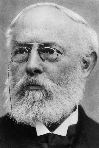
| Wesel 2020 mayoral election as a percentage % 60 50 40 30 20 10 0 50,6 % 29,7 % 11,2 % 4,9 % 3,6 % West-kamp Hense Gorris Brem-kens Wagner The first female mayor in the history of the city of Wesel is Ulrike Westkamp (SPD). She was elected to this office for the first time in 2004 and was re-elected in the first round in 2009, 2014 and 2020.
|
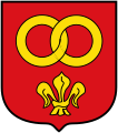
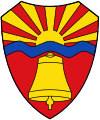
Coat of arms, flag, seal and logo
· 
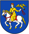
Coat of arms
· 
Coat of arms of the former municipality of Obrighoven-Lackhausen
· 
Coat of arms of the former municipality of Flüren
· 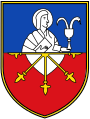
Coat of arms of the former municipality Bislich
· 
Coat of arms of the former municipality Büderich
· 
Flag
· ![]()
Logo
Blazon: "The coat of arms of the city of Wesel shows a silver heart shield in a red field, accompanied by three silver weasels jumping to the left. “
Meaning: The heart shield refers to the equestrian seal of the Duke of Cleves. The weasel has been handed down as a coat of arms of the town since the 13th century and figuratively translates the name of the town. The coat of arms is used in its current form after a change in the main statutes in 1984.
Flag: As flag the city of Wesel uses the colors red-white-red (cross-striped in the ratio 1:3:1). In the middle of the white web the coat of arms of the city.
Seal: The city of Wesel has an official seal with the city coat of arms.
Town twinning, sponsorships and friendships
The city of Wesel maintains several town twinning arrangements, most of which have been built up over many years through private, school and club contacts:
- In 1952 a partnership with Hagerstown in Maryland/USA was established, one of the oldest German-American city partnerships ever.
- In 1972 Felixstowe in the county of Suffolk in Great Britain followed.
- In 1990, after the reunification, the city of Wesel became twinned with Salzwedel in Saxony-Anhalt.
- The most recent partnership was established in 2002 with the town of Kętrzyn (formerly Rastenburg in East Prussia) in Poland.
Furthermore, Wesel is the sponsor city of the supply ship "Rhein" of the German Navy and of the telecommunications battalion 284 of the German Federal Armed Forces stationed in Wesel (since 2003) and, since 2014, of an Airbus 320 of Lufthansa.
There have been contacts with Lisieux (France) for many years through a lively student exchange.
Related articles
Author
AlegsaOnline.com Wesel — city on the Rhine in North Rhine-Westphalia Leandro Alegsa
URL: https://en.alegsaonline.com/art/107313