Watling Street: ancient trackway and Roman road across England
Watling Street is an ancient east–west trackway in England, later engineered by the Romans and preserved in parts as modern roads (notably the A2 and A5); it remains important to archaeology and local history.
Overview
Watling Street is the name given to a long-established east–west trackway and later to one of the principal Roman roads in what is now England. The route evolved over many centuries: originally a prehistoric and Iron Age track used by local communities, it was taken over, aligned and in places paved by the Romans, then continued in use through the medieval, early modern and modern eras. Its course survives in road layouts, place names and archaeological remains.
Image gallery
10 Images


Name and origins
The term “street” derives from Old English stræt, itself from Latin strata, meaning a paved way; this reflects the Roman investment in surfacing important routes. The earliest sections of Watling Street appear to have been established by Ancient Britons as a route between settlements such as Canterbury and St Albans. Over time the corridor was extended by successive users and administrations, so that the name covers a complex of alignments rather than a single immutable road.
Roman engineering and development
When the Roman administration organised transport and communication across the province they formalised Watling Street as a major axis. On important sections they constructed a raised agger (bank), installed roadside ditches for drainage, and laid a metalled surface suitable for wheeled traffic and military movement. The road formed part of the wider network commonly termed Roman roads in Britain, connecting legionary bases, towns, ports and forts.
Route and modern equivalents
The ancient alignment can be traced in parts of the modern road system. Between Dover and London the corridor largely corresponds with the modern A2, while northwest from London much of the historic line is followed by the A5 towards Wroxeter (the Roman Viriconium). Other stretches lead toward towns such as Canterbury and reach as far as Caerwent near the Severn estuary. Along its length the old road survives as names in lanes, parish boundaries and local routes.
Historic events and associations
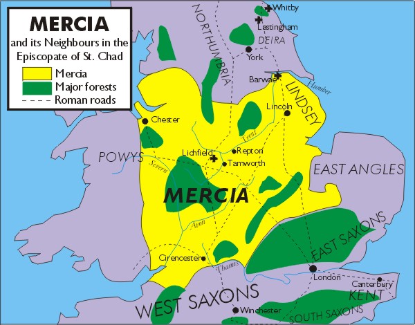
Watling Street is linked with several well-known episodes in British history. Traditional accounts place the final battle of Boudica, the Iceni queen who rebelled against Roman rule, somewhere near the line of the road, at locations suggested by archaeology and place-name evidence such as Mancetter. In the early medieval period sections of the road were important markers and corridors; for example, parts of the route later served as the southwestern boundary of the Danelaw.
Post-Roman and later use
After the Roman withdrawal the route remained a principal artery for movement, trade and communication. During the coaching and turnpike periods the London–Channel alignment was improved and in the early 19th century came to be known in places as the Great Dover Road, linking London to the English Channel and the port approaches to Dover. Local turnpike trusts repaired and supervised stretches, reinforcing the road’s continued economic importance.
Archaeology, preservation and legacy
Archaeological work along the Watling Street corridor has produced Roman paving, agger profiles, culverts, milestones and occasional finds related to roadside settlement. These investigations have helped map phases of construction and successive realignments. Modern highways and development can threaten remains, but conservation efforts, scheduling of remains and local heritage projects aim to protect visible and buried features connected with the road. For detailed study, specialists consult excavations, fieldwalking records and county histories as well as the corpus of Roman milestones and itineraries.
Why Watling Street matters
Watling Street demonstrates continuity of movement over millennia: a prehistoric track that became a Roman arterial road, then a medieval thoroughfare and finally part of the modern transport network. Its survival in place names, alignments and archaeology illustrates how infrastructure shapes settlement, economy and landscape. The road provides a tangible link between ancient communication strategies and contemporary transport corridors, and it remains a subject of local interest, scholarly research and wider public heritage.
Key points
- Originated as a prehistoric and Iron Age track between places such as Canterbury and St Albans, used by Ancient Britons.
- Incorporated into the Roman road network and engineered for military and commercial use by the Romans.
- Sections correspond with modern routes including the A2 and the A5, while the name survives locally in many places.
- Associated with the defeat of Boudica and with boundaries such as the Danelaw.
- Later improvements produced the Great Dover Road and links to Channel ports such as Dover and ferry approaches.
For further reading and region-specific accounts see archaeological reports and local histories; many online and print resources provide detailed maps, excavation summaries and discussions of how Watling Street developed from a worn track into a metalled Roman road and, ultimately, a backbone of England’s road network. Additional reference points and summaries can be found through general works on Roman roads in Britain, local county studies and historical atlases that chart the road’s changing alignments and surviving monuments.
Questions and answers
Q: What is Watling Street?
A: Watling Street is an ancient route in England, used by the Ancient Britons and later used by the Romans.
Q: Where does Watling Street stretch to?
A: Watling Street stretched to Caerwent in Wales on the Severn estuary, just west of Chepstow.
Q: What is the origin of the name 'Street' in Watling Street?
A: The name 'Street' in Watling Street comes from the old word for paving.
Q: Which major Roman roads does Watling Street correspond to?
A: Watling Street corresponds to the Roman road that goes from London to the port of Dover, and from London to St Albans.
Q: Which modern roads in England follow the same path as Watling Street?
A: The A2 road from Dover to London, and the A5 road from London to Wroxeter (Roman Viriconium, in modern Shropshire) follow the same path as Watling Street.
Q: What happened in Mancetter on Watling Street?
A: Mancetter on Watling Street is thought to be the site of Boudica's defeat by the Romans.
Q: When did the course between London and the Channel become paved and what was it called?
A: In the early 19th century, the course between London and the Channel was paved and became known as the Great Dover Road.
Related articles
Author
AlegsaOnline.com Watling Street: ancient trackway and Roman road across England Leandro Alegsa
URL: https://en.alegsaonline.com/art/106882