Water on Mars: distribution, evidence, and significance
Summary of the forms, geological evidence, history and modern implications of water on Mars, and how spacecraft observations have revealed ice, hydrated minerals and transient flows.
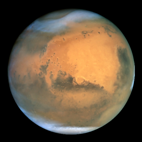
The presence and history of water on Mars is central to understanding the planet's climate, geology and potential for past life. Mars holds far less water overall than Earth, but the water that does exist is distributed in several distinct reservoirs. Most of the known inventory today is frozen in the planet's cryosphere and polar deposits rather than as stable surface liquid.
Image gallery
10 Images


Current distribution and physical state
On present-day Mars water is chiefly found as ice: in the polar layered deposits, in shallow permafrost, and in buried glaciers. Scientific descriptions of Mars' near-surface water commonly use the term cryosphere to indicate the frozen portion of the crust. Permafrost-like ground ice and seasonal frost also occur in many latitudes (permafrost), while only trace amounts appear as vapor in the thin atmosphere (water vapor). The planet's low mean atmospheric pressure and cold temperatures generally prevent long-lived liquid water on the surface (freezing and sublimation), except perhaps for very brief, localized occurrences under special circumstances.
Evidence for past and transient liquid water
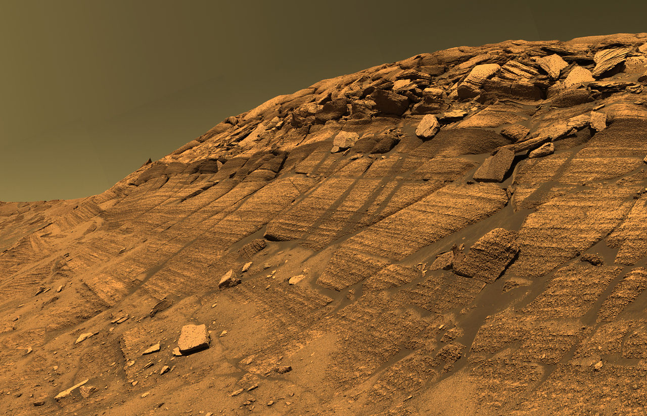
Geological features indicate that Mars once supported much more active hydrology. Dried river channels, delta deposits and basin shapes suggest rivers, lakes and possibly ocean-scale bodies in the ancient past (ancient oceans). Many craters and landscapes show erosion patterns consistent with flowing water rather than only wind-driven processes. In addition to surface morphology, mineralogical signatures point to interactions with liquid: certain iron oxides and hydrated silicates form in watery environments.
Observations from spacecraft and remote sensing
Robotic missions and orbital instruments have documented both surface features and subsurface ice. Early and later missions — including several flybys and orbiters such as those commonly grouped under Mars flybys and orbiters — used cameras and spectrometers to map valleys, possible lake basins and glacial deposits. The Mars Reconnaissance Orbiter and other craft returned high-resolution images revealing apparent ancient lakes (paleolakes), extensive valley networks (river valleys) and signs of past glaciation (glaciation). Radar instruments have detected bright returns consistent with buried ice bodies (radar), and focused radar studies have identified kilometer-scale ice-rich deposits interpreted as glaciers.
Mineralogy, surface features and in situ findings
Spectroscopic measurements and rover investigations have identified minerals that typically require water to form. Examples include altered iron minerals and hydrated silica such as hematite and opal, as well as clay minerals and sulfates. Erosion and infill patterns in craters and basins preserve records of aqueous activity, helping researchers reconstruct the timing and chemistry of past water-rock interactions.
Direct detections and seasonal phenomena
Landers and surface missions have provided direct evidence of near-surface ice and transient water-related phenomena. The Phoenix lander observed subsurface ice and documented seasonal frost behaviors and brine-relevant processes; subsequent analysis noted frost and occasional small-scale melting or mobilization events (snow and frost). More recently, recurring dark streaks on steep slopes — sometimes called recurring slope lineae — have been linked in some studies to transient briny flows, though their exact origin remains debated.
Why water on Mars matters
- Science: Water is the key agent of erosion and alteration, and its past presence implies a warmer, wetter climate conducive to prebiotic chemistry.
- Astrobiology: Persistent or episodic liquid water increases the probability that microbial life could have arisen or persisted in Mars' past.
- Exploration: Subsurface ice is a resource for future human missions, offering potential drinking water, oxygen and fuel feedstock.
Ongoing and planned missions continue to refine the picture of Martian water by combining imagery, radar sounding, chemistry and in situ sampling. Each line of evidence — morphology, mineralogy, remote sensing and lander observations — contributes to a progressively detailed understanding of how water shaped Mars and what remains available today for science and exploration.
Key spacecraft and data sources include several well-known missions and instruments cited above, each contributing unique measurements and context: mission overviews, high-resolution orbiters like MRO, studies of ancient basins (paleolake mapping), valley networks (fluvial mapping), glacial evidence (glacial studies), radar detection (radar data), targeted radar analyses (detailed radar studies), and surface confirmation from missions such as Phoenix with its observations of frost and snowlike deposition.
Questions and answers
Q: What is the main source of water on Mars?
A: The main source of water on Mars is the cryosphere, which includes permafrost and polar caps.
Q: Is there liquid water on Mars?
A: No, there is no liquid water on Mars. The average atmospheric pressure and temperature are far too low for liquid water to exist in the long-term.
Q: Did Mars ever have liquid water flowing on its surface?
A: It seems that Mars once had liquid water flowing on its surface, making large areas like Earth's oceans. There are a number of signs that suggest this was the case in the past or even now.
Q: What evidence suggests that there may have been liquid water on or under the surface of Mars?
A: Evidence suggesting that there may have been liquid water on or under the surface of Mars includes stream beds, polar caps, spectroscopic measurement, eroded craters, minerals such as goethite and hematite which are often formed when there is liquid water present, phyllosilicates, opal and sulfate deposits.
Q: What instruments were used to take pictures of what seem to be ancient lakes and rivers valleys?
A: Instruments such as Viking flybys, Mars Odyssey mission,Mars Global Surveyor mission ,Mars Express mission and the Mars Reconnaissance Orbiter took pictures of what seem to be ancient lakes and river valleys.
Q: What did Phoenix lander show when it was landing?
A: The Phoenix lander showed ice when it was landing as well as melting ice snow falling and even drops of liquid water.
Q: Was a recent report able to confirm any presence of Martian dark streaks due to presence of Water ?
A: Yes , a recent report confirmed that Martian dark streaks were affected by presence of Water .
Related articles
Author
AlegsaOnline.com Water on Mars: distribution, evidence, and significance Leandro Alegsa
URL: https://en.alegsaonline.com/art/106802
Sources
- windows.ucar.edu : "Mars Global Surveyor measures water clouds"
- space.com : "Flashback: water on Mars announced 10 Years Ago"
- science.nasa.gov : "Science@NASA, The Case of the Missing Mars Water"
- psrd.hawaii.edu : "PSRD: Ancient Floodwaters and Seas on Mars"
- spaceref.com : "Gamma-Ray Evidence Suggests Ancient Mars Had Oceans | SpaceRef – Your Space Reference"
- ui.adsabs.harvard.edu : 2003JGRE..108.5042C
- doi.org : 10.1029/2002JE001963
- esa.int : "Water at Martian south pole"
- history.nasa.gov : "ch4"
- ui.adsabs.harvard.edu : 2005JGRE..11012S16H
- doi.org : 10.1029/2005JE002455
- ui.adsabs.harvard.edu : 2005JGRE..11012S14H
- doi.org : 10.1029/2005JE002459
- itv.com : "Articles | Was there life on Mars? – ITV News"
- dx.doi.org : 10.1029/2004JE002389