Washington County, Kansas
Rural county in north-central Kansas with county seat Washington. Agricultural economy and small towns; 2010 census recorded 5,799 residents.
Overview
Washington County (abbreviation: WS) is a county in the United States located in the north-central portion of the state. It is organized as a rural government area and is identified on maps as a county within the U.S. state of Kansas. According to the 2010 census, the county's population was 5,799. The county seat and largest community is the city of Washington, which also serves as the principal center for local administration and services (county seat).
Image gallery
2 Images
Geography and communities
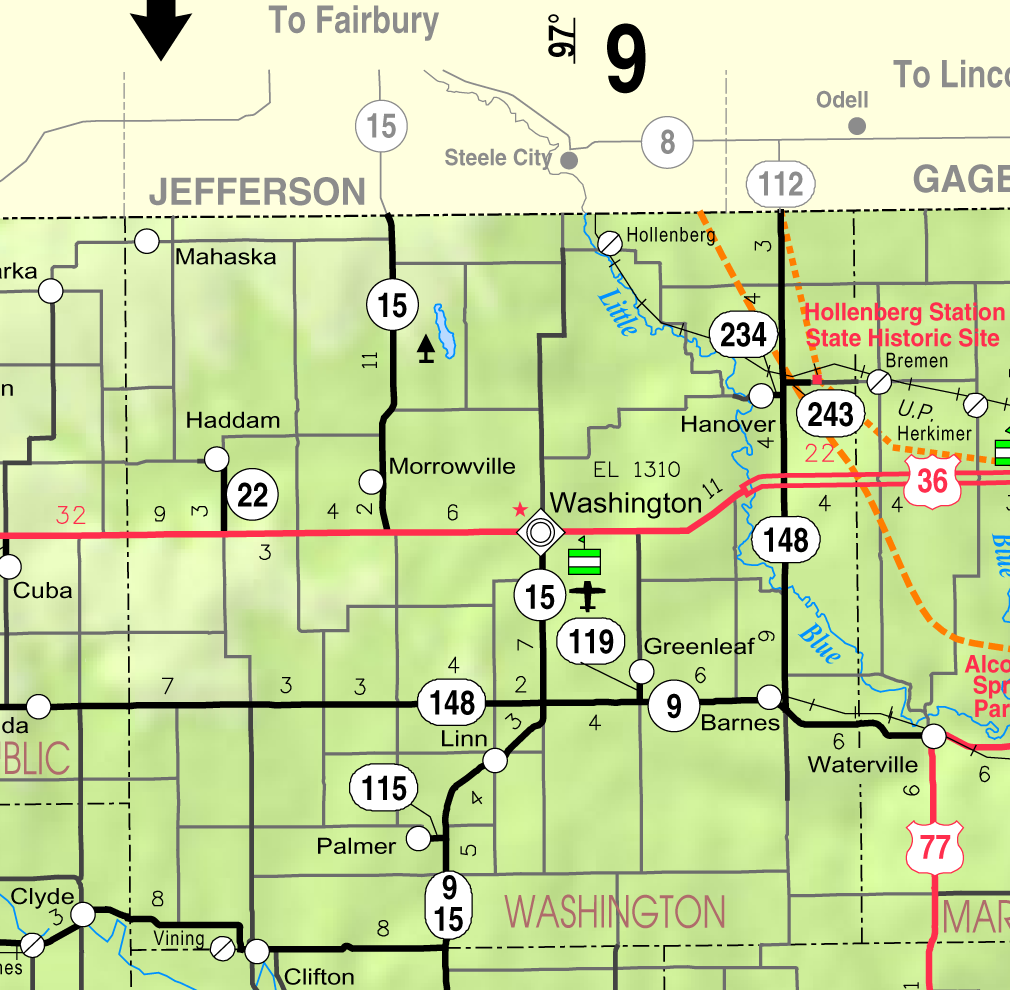
Washington County covers predominantly agricultural land with a mix of small towns, farms and open prairie. Rolling fields, pastures and windbreaks are typical of the landscape. Settlements are dispersed; the county seat concentrates many community functions such as courts, libraries and business services. Transportation within the county relies on state highways and a network of county roads that link farmsteads to towns.
History and development
The county was settled during the westward expansion of the 19th century and developed around farming and local trade. Towns grew where rail lines, stage routes or fertile land converged, and civic institutions were established in the county seat. Over time, agricultural mechanization and population shifts have shaped the county's size and settlement patterns.
Economy and public services
The local economy is centered on agriculture—crop farming and livestock production—supplemented by small businesses, public-sector employment and services that support rural life. Public services include county government offices, schools serving local districts, volunteer fire and emergency services, and primary-care clinics. Tourism is modest and typically tied to regional events, outdoor recreation and community festivals.
Notable facts and distinctions
- Washington functions as the county's administrative and commercial hub.
- The county maintains a low population density compared with urban areas, reflecting its agricultural character.
- Historic buildings, community museums and annual events preserve local heritage and civic identity.
For more detailed maps, demographic trends and government contacts, refer to county resources and regional planning agencies that track rural development and services.
Questions and answers
Q: Where is Washington County located?
A: Washington County is located in the U.S. state of Kansas.
Q: What is the standard abbreviation for Washington County?
A: The standard abbreviation for Washington County is WS.
Q: How many people lived in Washington County in 2010?
A: In 2010, 5,799 people lived in Washington County.
Q: What is the county seat of Washington County?
A: The county seat of Washington County is Washington.
Q: Which city is the biggest in Washington County?
A: Washington is the biggest city in Washington County.
Q: How can Washington County be abbreviated?
A: Washington County can be abbreviated as WS.
Q: In which US state is Washington County located?
A: Washington County is located in the U.S. state of Kansas.
Related articles
Author
AlegsaOnline.com Washington County, Kansas Leandro Alegsa
URL: https://en.alegsaonline.com/art/106680
Sources
- quickfacts.census.gov : "State & County QuickFacts"
- naco.org : "Find a County"
- gpace.org : Keystone Pipeline - Marion County Commission calls out Legislative Leadership on Pipeline Deal; April 18, 2010.
- www2.ljworld.com : Keystone Pipeline - TransCanada inspecting pipeline; December 10, 2010.
- census.gov : "US Gazetteer files: 2010, 2000, and 1990"
- census.gov : "Population and Housing Unit Estimates"
- census.gov : "U.S. Decennial Census"
- mapserver.lib.virginia.edu : "Historical Census Browser"
- census.gov : "Population of Counties by Decennial Census: 1900 to 1990"
- census.gov : "Census 2000 PHC-T-4. Ranking Tables for Counties: 1990 and 2000"
- uselectionatlas.org : uselectionatlas.org/RESULTS/
- usd108.org : "Washington County"
- usd108.org : "Elementary Personnel"
- usd108.org : "Personnel"