
Wabaunsee County, Kansas
Wabaunsee County is a rural county in east-central Kansas with Alma as its county seat. Created in 1859 and named for a Potawatomi chief, it had 7,053 residents at the 2010 census.
Overview
Wabaunsee County is a largely rural county in the U.S. state of Kansas. The county government is based in the small city of Alma, the county seat. Population recorded by the 2010 census was 7,053 residents, reflecting a low-density mix of agricultural land, grasslands and small settlements. The county is part of the broader landscape of central United States counties that combine farming, ranching and small-town life.
Image gallery
5 Images
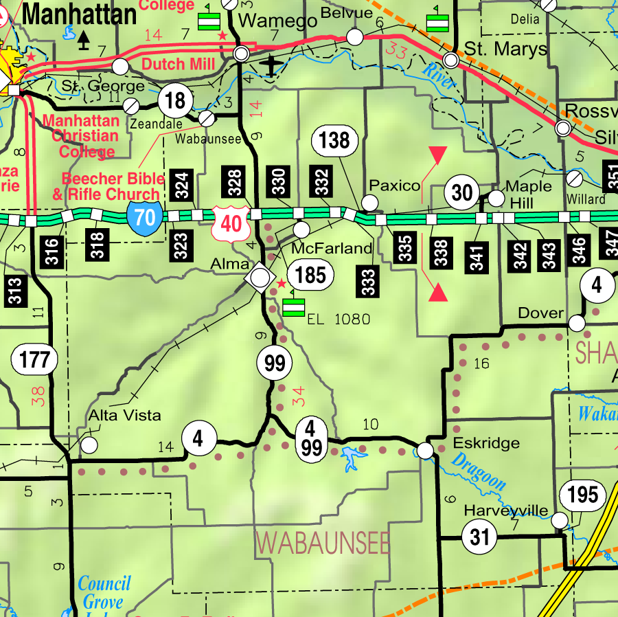


Geography and communities
Wabaunsee County contains a mixture of rolling prairie and portions of native tallgrass, with land divided among farms, pastures and scattered residential clusters. Transportation and local roads connect its communities to larger urban centers in Kansas and neighboring counties. The county includes incorporated and unincorporated places, public lands and locally managed parks and recreation areas that serve residents and visitors.
History
The county was established by the territorial legislature on March 25, 1859. Its name honors a Potawatomi leader; place-names that commemorate Native American figures are common across Kansas and the Midwest. Wabaunsee County developed in the 19th century as settlers arrived, establishing farms, towns and local institutions that remain part of its civic fabric today. Historical records and local museums preserve stories of settlement, agriculture and community life.
Economy and government
Economic activity in the county centers on agriculture, livestock and supporting services, together with small businesses and municipal employment. The county commission and elected officials manage public services such as roads, public safety and local planning. Schools, churches and civic organizations form the backbone of many communities and help coordinate cultural and recreational programs.
Notable facts and resources
Wabaunsee County is named for a Potawatomi chief and remains an example of Kansas counties with low population density and long agricultural traditions. For demographic and administrative details consult local government sources and census summaries. Further information can be found through state and regional resources: state references, census data, and county-level portals such as the seat at Alma or other municipal listings online.
- Established: March 25, 1859
- County seat: Alma
- 2010 population: 7,053
This article provides a concise introduction to Wabaunsee County and points to official and archival sources for readers seeking maps, records or deeper historical and demographic research.
Questions and answers
Q: What is Wabaunsee County?
A: Wabaunsee County is a county located in the U.S. state of Kansas.
Q: How many people lived in Wabaunsee County in 2010?
A: In 2010, 7,053 people lived in Wabaunsee County.
Q: What is the county seat of Wabaunsee County?
A: The county seat of Wabaunsee County is Alma.
Q: When was Wabaunsee County created?
A: Wabaunsee County was created on March 25, 1859 by the territorial legislature of Kansas Territory.
Q: Who was Wabaunsee County named after?
A: Wabaunsee County was named after a chief of the Potawatomi Indians.
Q: What is the standard abbreviation for Wabaunsee County?
A: The standard abbreviation for Wabaunsee County is WB.
Q: What is the history of Wabaunsee County?
A: The county was created in 1859 and was named after a chief of the Potawatomi Indians. The county seat is Alma, and 7,053 people lived there in 2010.
Related articles
Author
AlegsaOnline.com Wabaunsee County, Kansas Leandro Alegsa
URL: https://en.alegsaonline.com/art/106075
Sources
- quickfacts.census.gov : "State & County QuickFacts"
- naco.org : "Find a County"
- kshs.org : Wabaunsee County, Kansas
- ks-wabaunsee.manatron.com : Wabaunsee County History.
- books.google.com : Kansas: A Cyclopedia of State History, Volume 2
- home.covad.net : Rock Island Rail History
- census.gov : "US Gazetteer files: 2010, 2000, and 1990"
- census.gov : "Population and Housing Unit Estimates"
- census.gov : "U.S. Decennial Census"
- mapserver.lib.virginia.edu : "Historical Census Browser"
- census.gov : "Population of Counties by Decennial Census: 1900 to 1990"
- census.gov : "Census 2000 PHC-T-4. Ranking Tables for Counties: 1990 and 2000"
- uselectionatlas.org : uselectionatlas.org/RESULTS/