Vistula
![]()
This article describes the river. For other meanings, see Vistula (disambiguation).
![]()
Vistula is a redirect to this article. For the asteroid see (16689) Vistula.
The Vistula (Polish Wisła (![]()
![]() [ˈvʲiswa]), Czech Visla, Latin Vistula) is a 1048-kilometre-long and, by European standards, largely unregulated and natural stream and the longest river in Poland. Its catchment area also includes parts of Slovakia, Belarus and Ukraine. The longest stretch of water in its river system is the 1213 river kilometres from the source of the Western Bug to the Baltic Sea.
[ˈvʲiswa]), Czech Visla, Latin Vistula) is a 1048-kilometre-long and, by European standards, largely unregulated and natural stream and the longest river in Poland. Its catchment area also includes parts of Slovakia, Belarus and Ukraine. The longest stretch of water in its river system is the 1213 river kilometres from the source of the Western Bug to the Baltic Sea.
On old maps one also finds the spellings W(e)ixel or Wissel.
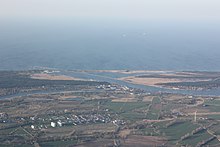
Estuary near Gdansk
_2010-07-13_269.jpg)
Port in Gdansk
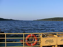
Mouth near Mikoszewo
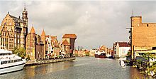
Gdansk in the Vistula Delta
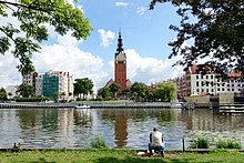
Elblag in the Vistula Delta
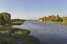
Malbork in the Vistula Delta
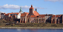
Grudziądz
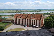
From Mewe Castle in Gniew
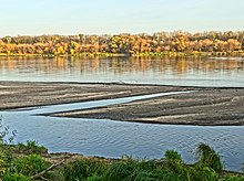
Bydgoszcz
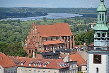
Chełmno
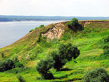
Dobrzyń nad Wisłą
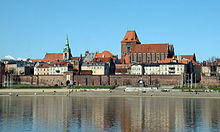
Toruń
.jpg)
Płock
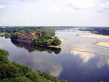
Confluence of the Narew (left) and Vistula (right) rivers near Modlin
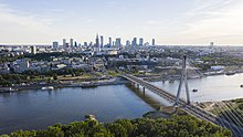
Warsaw New Town
.jpeg)
Warsaw Old Town
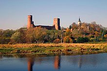
Castle in Czersk
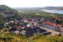
Vistula breakthrough near Kazimierz Dolny
.jpg)
Vistula breakthrough near Janowiec
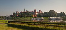
Wawel in Krakow
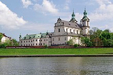
Pauline Basilica in Kazimierz
.jpg)
Castle in Sandomierz
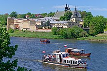
Norbertine convent in Krakow
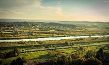
From Wartenberg Castle
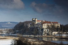
Krakow Gate near Tyniec
.png)
Location of the Vistula in the Polish water network
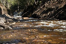
Source river Czarna Wisełka
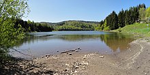
Jezioro Czerniańskie
Etymology
There is disagreement as to whether the name Vistula is of Indo-European or pre-Indo-European origin. The Polish name Wisła is derived from the Latin Vistla. The letter pair -tl- was simply replaced by the Polish -ł-. This is then also the name of the first town through which the Vistula flows.
History
Upper reaches
Silesian Beskids and Silesian Foothills
The stream rises on the municipal territory of the town of the same name in the Silesian Beskids at an altitude of 1107 m above sea level and 1080 m above sea level respectively on the south-western slope of Barania Góra from the streams Czarna Wisełka and Biała Wisełka, which flow into the Jezioro Czerniańskie reservoir after nine and seven kilometres respectively. The outflowing mountain stream bears the name Wisełka and becomes the Vistula only from the confluence of the Malinka. In Ustroń it leaves the Silesian Beskids and flows through the densely populated Silesian Foothills around Skoczów, where it takes in the Brennica, which also rises in the Silesian Beskids.
Auschwitz Basin and Krakow Gate
After leaving the mountains, the Vistula flows into the Auschwitz Basin and turns east, where it forms a part of the historical border between Upper Silesia and Lesser Poland. Shortly after Strumień it flows into the Goczałkowice reservoir. Below the dam it is navigable. Beyond Auschwitz and taking in the Soła, the wide Auschwitz Basin narrows to form the Kraków Gate between the Groß Salzer Mountains to the south and the Tenczyn Ridge, part of the Kraków-Czestochowa Jurassic, to the north. About 70 km after the reservoir, the Vistula River flows through the old royal city of Kraków.
Sandomir Basin
In Kraków, the Vistula leaves the narrow Kraków Basin and flows into the large tectonic depression of the Sandomir Basin, where it receives the waters of numerous Carpathian rivers from the right, draining the Beskydy, Pieniny and Tatra Mountains. In the Sandomir Basin, the Vistula flows eastward, along the southern edge of the Cracow-Czestochowa Jura and the Holy Cross Mountains. To the south of the basin joins the Carpathian foothills and then to the east the Roztocze. From Niepołomice 25 km east of Kraków to just below the mouth of the San River, the Vistula was the border between Habsburg Galicia and the Russian Empire from 1815 to 1916. 70 km beyond Niepołomice, the Dunajec, which has its source in the High Tatras, flows into the Vistula. Soon after Sandomierz, the San, the easternmost Carpathian river, flows into the Vistula from the Bieszczady. The upper course of the Vistula ends with the confluence of the two rivers south of Zawichost.
Middle course
Lesser Poland Vistula Breakthrough
From Zawichost begins the Little Poland Vistula Breakthrough through the Polish Uplands between the Lublin Uplands to the east and the Kielc Uplands to the west. Here it flows past old trading towns such as Kazimierz Dolny and Janowiec.
Masovian Plain
Further north at Puławy, the Vistula reaches the Polish Plain, specifically the Mazowieckie Plain. Its barely regulated middle course is characterised by numerous meanders and sandbanks, which make navigation difficult. At the northern edge of its middle course, the Vistula flows through the Polish capital in the Warsaw Basin.
Underflow
Urstromtäler
The lower course begins at the confluence of the Narew and the Vistula. Shortly after Warsaw, it enters the area of predominantly east-west oriented glacial valleys, through which the Bug and Narew flow to it from the east, united shortly before. Here it turns sharply westward in the Warsaw-Berlin glacial valley, which is joined by the Thorn-Eberswalde glacial valley, and passes Płock, Dobrzyń nad Wisłą, Włocławek, and Thorn. At Włocławek there has been a large weir with a hydroelectric power station since 1970.
Near Bydgoszcz, whose city centre is not on the river, it leaves the large east-western glacial valley and breaks through the Baltic land ridge in the Fordon breakthrough in the Lower Vistula Valley. This comprises the Pomeranian Lake District between the Vistula and the Oder, and the Masurian Lake District between the Vistula and the Njemen. In the last two decades of the 20th century extensive regulation measures were carried out at the middle course to improve the navigability.
Delta
→ Main article: Vistula Delta
The inflow of the river into the Baltic Sea was naturally blocked by the dune ridge of the Gdansk inland spit, the western part of the Vistula Spit (Mierzeja Wiślana). A delta has formed between the land ridge and the dune ridge. Shortly after Gniew (Mewe), the Nogat branches off to the east, which only became an independent river (again) in 1371 due to a flood and flows into the Vistula Lagoon (Polish: Zalew Wiślany, i.e. Vistula Lagoon) in the area of the Elbinger Niederung. Just before the Dune Ridge, the main stream of the Vistula naturally branched into the Elbinger or Königsberger Vistula (Szkarpawa), which also flows into the Vistula Lagoon and was the main stream until the beginning of the 19th century, and into the Gdansk Vistula, which broke through the Dune Ridge near the city of Gdansk and which flowed into the Gdansk Bay (Polish Zatoka Gdańska). In 1840, a flood created a new Vistula breach halfway between the fork and Gdansk, after which the western lower part of the old estuary silted up. Then, in the years 1889 to 1895, the dune ridge at the fork was pierced to reduce the flood threat to the Vistula delta. Since most of the Vistula water flows through this Vistula culvert, Polish Przekop Wisły, into the Baltic Sea, the Gdansk Vistula silts up altogether and has increasingly been called the Dead Vistula, Polish Martwa Wisła.
The eastern branch of the Vistula, Szkarpawa, has in turn formed a delta. Its northernmost arm is still called Wisła Królewiecka (Königsberg Vistula).
Search within the encyclopedia