Upper Bavaria (Oberbayern): region, administration and features
Upper Bavaria (Oberbayern) is a southeastern Bavarian administrative region with Munich as its seat. It combines Alpine landscapes, major lakes, a strong economy and important cultural traditions.
Upper Bavaria (German: Oberbayern) is a historic and administrative region in the southeast of the Free State of Bavaria, Germany. It functions both as a governmental district (Regierungsbezirk) and as a collection of self-governing counties and independent cities. The region's administrative capital and largest city is Munich, which serves as the seat of the regional government and as the economic and cultural center for the area. ![]()
Image gallery
3 Images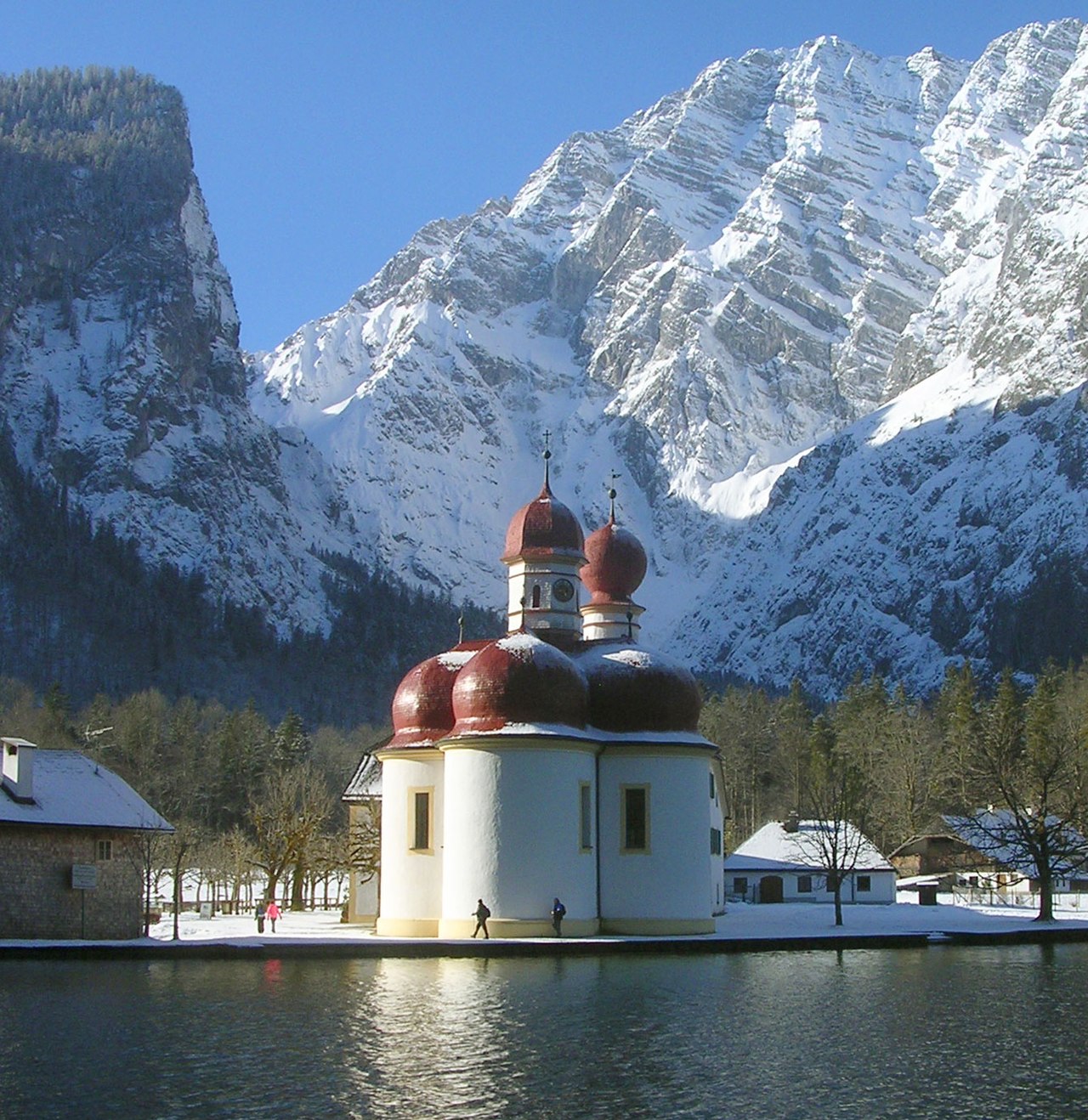


Geography and landscape
Upper Bavaria ranges from the northern fringes of the Alpine foothills to higher mountains along the border with Austria. The southern part contains parts of the Bavarian Alps and several well-known lakes, including the Chiemsee, Starnberger See and Ammersee, which are popular for tourism and recreation. Major rivers such as the Isar and the Inn drain the region; portions of the Danube's tributary system are also present. The terrain produces marked climatic contrasts: milder lowlands around Munich and cooler, wetter conditions in the alpine and pre-alpine zones.
Administrative structure and settlements
As a Regierungsbezirk, Upper Bavaria is subdivided into multiple Landkreise (rural districts) and Kreisfreie Städte (independent cities). Munich is the dominant metropolis, followed by other important urban centres including Ingolstadt, Rosenheim, Freising, Erding, Garmisch-Partenkirchen, Weilheim and Traunstein. Local government responsibilities are distributed between municipal authorities, district administrations and the regional government, which acts as the state's representative for planning, supervision and coordination.
History and development
The name "Upper Bavaria" appears in medieval sources and reflects a historic regional division of the Duchy of Bavaria. Over the centuries boundaries and administrative uses of the term have shifted several times. In the early 19th century Bavaria reorganized its internal administration during post-Napoleonic reforms: initially arranged into river-based districts, the territory was later renamed and adjusted to reflect traditional regional identities, creating the modern form of Regierungsbezirke such as Upper Bavaria. The area was long associated with the Wittelsbach dynasty, which shaped much of its political and cultural development.
Economy and infrastructure
Upper Bavaria is one of Germany's most prosperous regions. Munich is a major economic hub with strengths in automotive manufacturing, engineering, information technology, finance, insurance and research. Notable companies and institutions based in the region have international reach, and the Technical University of Munich and Ludwig Maximilian University are important centers of higher education and innovation. Transportation infrastructure includes Munich Airport (located in the Freising district), extensive rail connections and major autobahns linking the region to the rest of Germany and to Austria.
Culture, tourism and notable features
Cultural life in Upper Bavaria mixes urban cultural institutions with strong rural and alpine traditions. Munich hosts world-famous events such as the Oktoberfest, and the region preserves customs in folk music, costume (Trachten), festivals and local crafts. Tourism is driven by mountain resorts (for skiing and hiking), historic towns, spas and lakeside recreation. Architectural attractions range from grand palaces and churches in Munich to lakeside monasteries and castles in the countryside.
Distinctive aspects and contemporary role
Upper Bavaria plays a central role in Bavaria's identity and economy. It has a dense population in and around Munich while maintaining extensive rural and mountainous areas in the south. The region's administrative label is used both for state-level government tasks and for a layer of local self-government, which can cause confusion for those unfamiliar with German administrative terminology. Linguistically, the area lies within the broader Bavarian dialect continuum; speech and customs vary substantially between the alpine south, regional towns and the cosmopolitan capital.
- Major cities: Munich, Ingolstadt, Rosenheim, Freising, Garmisch-Partenkirchen.
- Natural highlights: Bavarian Alps, Chiemsee, Starnberger See, Isar valley.
- Economic highlights: automotive and technology clusters, strong services sector, international airport.
Understanding Upper Bavaria requires attention to its layered identity: a historic region, a modern administrative district, and a varied landscape that ranges from an international metropolis to Alpine villages. Its influence on Bavarian culture, economy and tourism makes it one of Germany's most prominent sub-national regions.

Planning Regions
Upper Bavaria comprises four planning regions. These are the planning region Ingolstadt, planning region Munich, planning region Oberland and planning region Südostoberbayern.
History
With the first Bavarian division of land in 1255, an independent duchy of Upper Bavaria was created under Ludwig the Strict, which, however, was not congruent with today's administrative district. After temporary reunification in 1340, the Duchy of Bavaria was divided into three parts in 1392: Bavaria-Munich and Bavaria-Ingolstadt were created in Upper Bavaria, and Bavaria-Landshut in Lower Bavaria. In addition, Bavaria-Straubing existed in Lower Bavaria as a fourth duchy since 1353. In 1505 all partial duchies were reunited.
For administrative purposes, Bavaria was subsequently divided into rent offices. Thus, in the south of the duchy, the Rentamt München and the Rentamt Burghausen were created. With the secularization in 1802/03, the territories of the Freising diocese became part of Bavaria. In 1810 the Rupertiwinkel came to Bavaria, the final border to Austria was not determined until 1816 with the Treaty of Munich, when the Duchy of Salzburg was ceded.
With the Bavarian Constitution of 1808, the systematic division of the now Kingdom of Bavaria into districts took place, which as central authorities did not correspond to today's counties, but to today's districts. In 1837, the romantically moved King Ludwig I. had the French naming system of the Bavarian districts according to river names replaced by historicizing names, which were supposed to reflect the history of the Bavarian parts of the country. As a result, the district of Upper Bavaria was created from the district of Isar. However, during the Nazi period, the designation "Kreis" was adapted to the Prussian designation "Regierungsbezirk". In addition, the Gau München-Oberbayern existed from 1930 to 1945, which had political significance from 1933 during the NS dictatorship.
The inner Bavarian borders have subsequently changed several times. In 1972 the city and the main part of the administrative district Neuburg a.d. Donau as well as the Fuchstal communities of the former administrative district Kaufbeuren fell to Upper Bavaria and the main part of the former administrative district Aichach to Swabia.
Related articles
Author
AlegsaOnline.com Upper Bavaria (Oberbayern): region, administration and features Leandro Alegsa
URL: https://en.alegsaonline.com/art/103478