
Unter den Linden: Berlin’s historic linden‑lined boulevard
Unter den Linden is a central Berlin boulevard known for its linden trees, major cultural institutions, historic monuments and long role as a ceremonial and urban spine connecting the former royal palace to Brandenburg Gate.
Overview
Unter den Linden is one of Berlin’s best‑known boulevards, running east–west through the Mitte district. Its name means "under the linden trees," a reference to the double row of linden (lime) trees that historically framed a broad pedestrian mall down the centre of the street. The avenue links the area around the former Stadtschloss and the Lustgarten with Pariser Platz and the Brandenburg Gate, and continues beyond the historic core in both directions as major thoroughfares. The thoroughfare occupies a central place in the city’s spatial and cultural identity and is frequently referenced in guides, histories and tourism literature about Mitte and Berlin.
Image gallery
10 Images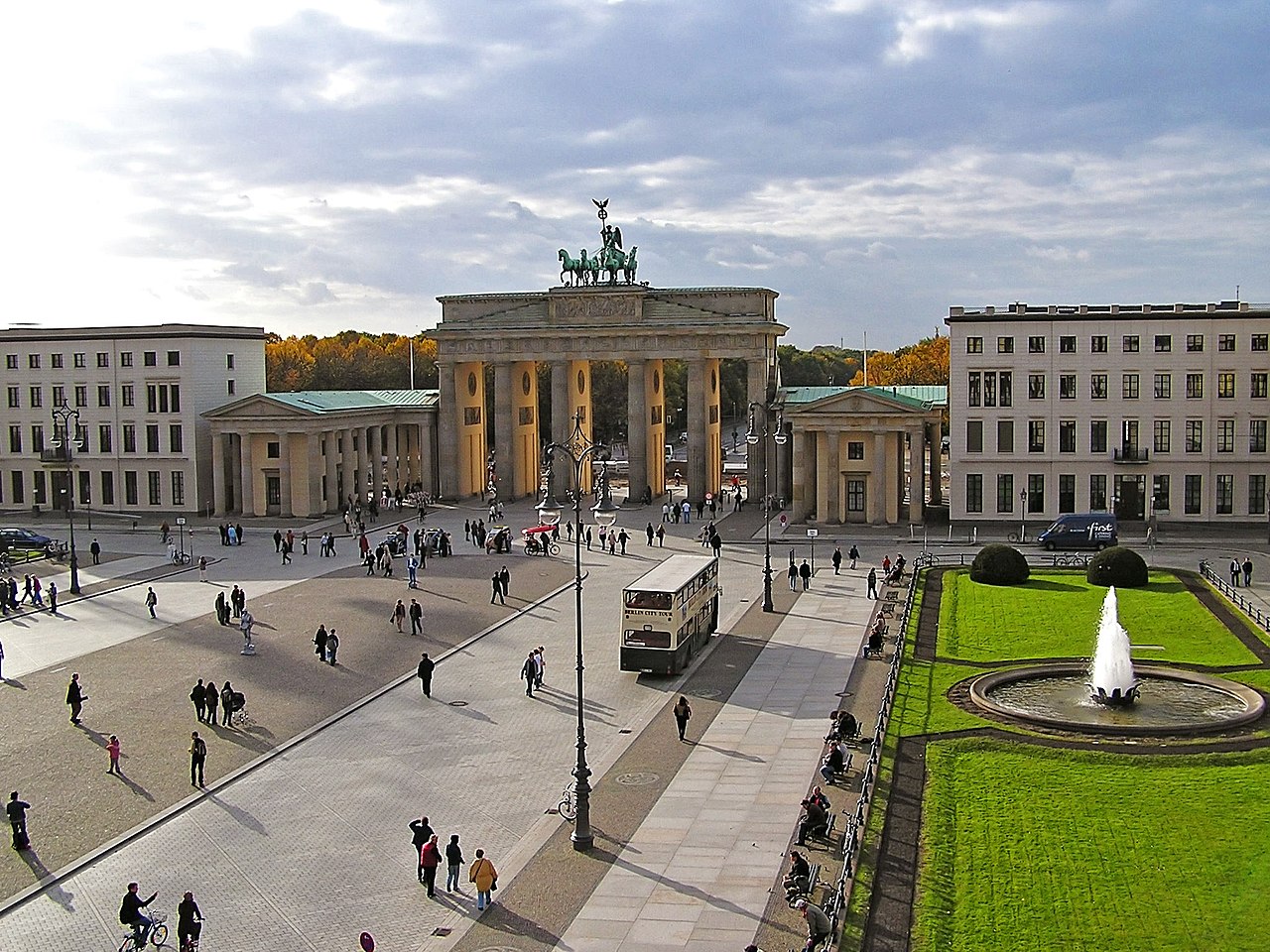






Physical characteristics and layout
Unter den Linden runs roughly east–west, with the river Spree nearby where the boulevard meets the island of museums. To the east the route becomes Karl‑Liebknecht‑Straße after crossing the Spree; to the west, beyond the Brandenburg Gate, it continues as Straße des 17. Juni. Major north–south streets intersecting the avenue include Friedrichstraße and Wilhelmstraße. The centre of the road historically contained a grassy promenade lined with trees and statues, with carriageways and sidewalks on either side. Modern road and pedestrian arrangements reflect repeated restorations after wartime damage, postwar repairs and recent city planning measures aiming to balance traffic, public space and preservation.
Historical development
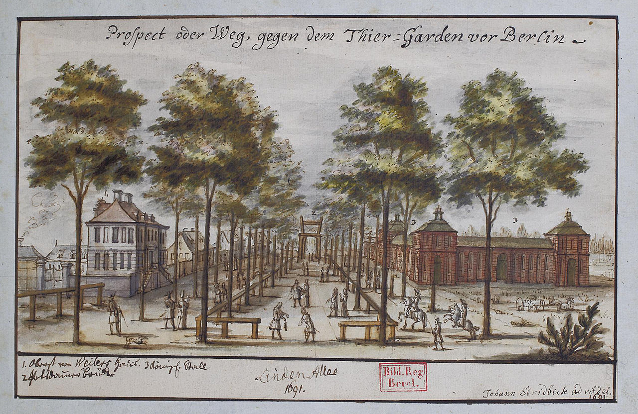
The site originally served as a bridle path laid out by Elector John George of Brandenburg in the 16th century to reach hunting grounds in the Tiergarten. In the 17th century the path was transformed into a tree‑lined promenade: linden trees were planted to create a formal approach between the royal palace and the city gates. Over the centuries Unter den Linden evolved from a princely avenue into a grand urban boulevard as Berlin expanded westward. It became a preferred location for public monuments, cultural institutions and elite residences.
War, restoration and the trees
Like many central European avenues, Unter den Linden suffered damage in the 20th century. During the construction of urban rail and wartime events many of the original trees were felled or destroyed. In the late 1930s work on underground infrastructure required removal of many lindens; further losses occurred during the final months of World War II when fuel shortages and combat led residents to cut trees for firewood and the fighting damaged the promenade. Most of today’s trees were replanted after 1945 and again in subsequent decades, though they continue to face pressures from air pollution, soil compaction and changes in urban microclimate. Conservation and periodic replanting remain part of managing the boulevard’s historic character.
Major buildings, monuments and institutions
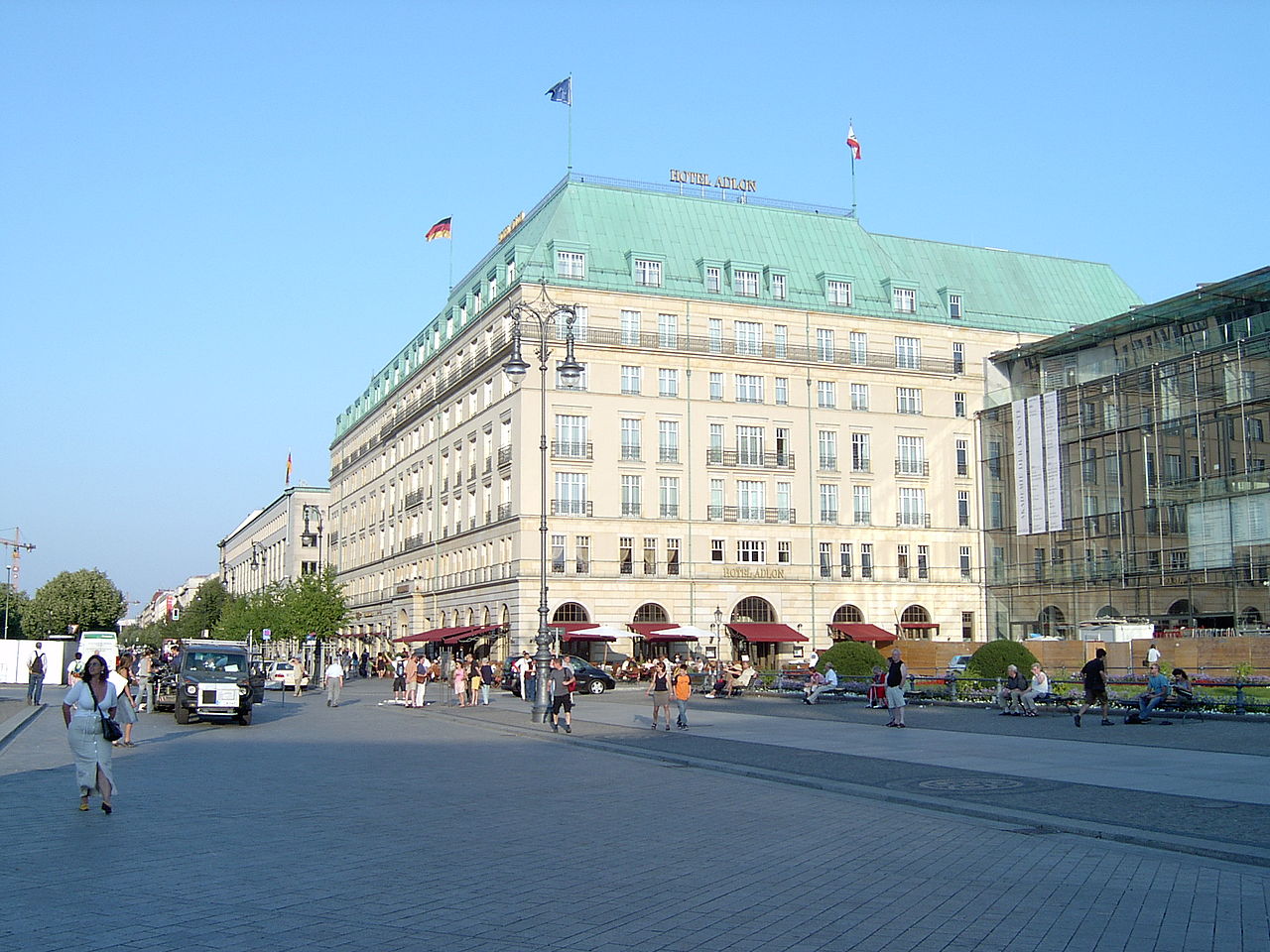
Unter den Linden hosts several of Berlin’s important cultural and historical sites. Walking from east to west, notable locations include the Zeughaus, an early 18th‑century arsenal now housing the Deutsches Historisches Museum; the former crown prince’s palace (Kronprinzenpalais); the Neue Wache, a neoclassical memorial often associated with the architect Karl Friedrich Schinkel; and the Staatsoper Unter den Linden (Berlin State Opera), traditionally nicknamed the Lindenoper. The avenue also borders the Humboldt University and historical residences such as the Altes Palais. At the western end near Pariser Platz stand the Hotel Adlon and diplomatic missions.
- Berlin Cathedral and Museum Island are close to the eastern approaches.
- The equestrian statue of Frederick the Great, created in the 19th century, stood on the central strip and remains a focal point of historical discussion (Frederick the Great).
- Memorials and statues honouring figures such as the Humboldt brothers, Scharnhorst and Bülow line portions of the avenue (Alexander Humboldt).
Uses, events and public life
The boulevard has long functioned as a ceremonial route and a setting for public events: parades, state processions and civic gatherings have all used Unter den Linden’s broad profile. It is a magnet for tourists who come to see the Brandenburg Gate, museums and monuments; it also serves neighborhood residents as a major urban axis for shopping, commuting and leisure. Since Berlin’s reunification and subsequent restoration projects, the avenue has been part of efforts to re‑establish historical sightlines and to integrate modern functions—such as cafés, cultural programming and interpretive signage—while respecting protected façades and public space.
Notable distinctions and practical information
Unter den Linden occupies a special place in Berlin’s urban memory because it served as a historic approach to the royal palace and later as an emblematic city boulevard. Its sequence of architectural styles—from baroque and neoclassical façades to reconstructed twentieth‑century buildings—illustrates Berlin’s layered history. Several buildings on the avenue are identified by traditional street numbers and houses of culture and state institutions. For visitors and researchers seeking more detailed orientation, guidebooks and municipal resources provide maps and histories; primary collections and museums adjacent to the avenue hold extensive documentation on its changing form and use. For referenced introductions and official overviews see local district pages and cultural institutions linked here: Germany, Brandenburg Gate, River Spree, bridle path origins, Thirty Years' War context, World War II effects, and items connected with buildings and embassies such as the former Soviet Embassy and the Hungarian Embassy. For architectural and memorial studies consult resources that discuss the Neue Wache and the work of Karl Friedrich Schinkel, or the history of the Berlin State Opera and references to imperial residences like those associated with Wilhelm I.
Questions and answers
Q: What is Unter den Linden?
A: Unter den Linden is a boulevard in the Mitte district of Berlin, Germany. It is named for its linden trees that line the grassed pedestrian mall in the middle of the road.
Q: Where does Unter den Linden run from and to?
A: Unter den Linden runs east–west from the site of the former Stadtschloss royal palace at the Lustgarten park, where the demolished Palast der Republik used to be, to Pariser Platz and Brandenburg Gate.
Q: Who ordered for linden trees to be planted along this boulevard?
A: The linden trees were planted by order of “Great Elector” Frederick William in 1647.
Q: What happened to most of these linden trees during World War II?
A: Most of these linden trees were cut down during 1934/35 when building a Nord-Süd-Tunnel for Berlin S-Bahn and during World War II, what remained was destroyed or cut down for firewood.
Q: When did numbering start on this street?
A: Numbering started on Unter den Linden since 1937 at Schlossbrücke (Palace Bridge).
Q: What are some notable buildings located along this street?
A: Notable buildings include Kronprinzenpalais (former palace of Hohenzollern crown princes), Neue Wache war memorial built in 1817, Berlin State Opera (Lindenoper), St. Hedwig's Cathedral, Altes Palais (favoured residence of Emperor Wilhelm I), main building of Humboldt University and House I of Berlin State Library as well as Russian Embassy and Hungarian Embassy.
Related articles
Author
AlegsaOnline.com Unter den Linden: Berlin’s historic linden‑lined boulevard Leandro Alegsa
URL: https://en.alegsaonline.com/art/103423
Sources
- gogermany.about.com : About.com Central Walking Path Unter den Linden