Ukraine: geography, history, government and contemporary overview
Comprehensive overview of Ukraine — its geography, history, political system, economy, culture, and recent events, with key facts and context for readers wanting a concise reference.
Ukraine (in Ukrainian, romanized) is a sovereign country in Eastern Europe. It is a unitary republic whose capital and largest city is Kyiv. The modern state emerged from centuries of regional history and was a constituent republic of the Soviet Union until declaring independence in 1991.
Image gallery
3 Images


Geography and neighbours
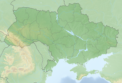
Ukraine occupies a large area of the European plain with varied terrain from fertile plains to forested highlands and a long coastline. Its international borders bring it into contact with many countries: Russia to the north‑east, Belarus to the north‑west, and European Union neighbours Poland and Slovakia to the west. To the south‑west lie Hungary, Romania and Moldova (including the breakaway region of Transnistria), while the Black Sea sits to the south.
Administrative and demographic features
Ukraine is divided into administrative regions (oblasts), each centered on a principal city. The Crimean peninsula is internationally recognised as part of Ukraine but has been under Russian control since 2014, a situation that remains a central element of contemporary politics. Ukrainian is the state language, and cities such as Kyiv, Kharkiv, Lviv and Odesa serve as cultural and economic hubs.
History and development
Territories of present‑day Ukraine were shaped by medieval states such as Kyivan Rus', later by Polish‑Lithuanian and Ottoman influences, and the Russian Empire. In the 20th century most of the area became part of the Soviet Union from 1922 until independence in 1991. Since independence Ukraine has undergone political and economic transformation, marked by mass protests in 2004 and 2013–14, Russia's annexation of Crimea in 2014, and a broader security crisis that escalated with the large‑scale invasion in 2022.
Economy, society and culture
The economy combines agriculture, heavy industry, mining and services; Ukraine is known as a significant grain producer and exporter. Its cultural life includes rich traditions in literature, music, folk arts and Orthodox Christian heritage. Language and regional identities vary, with Ukrainian as the predominant national language and sizeable minority communities speaking other languages.
Importance and current issues
Ukraine's strategic location, agricultural capacity and industrial base make it important to European and global security, trade and energy transit. Key contemporary issues include territorial integrity, reforms in governance and the economy, relations with the European Union and NATO aspirational dynamics, and humanitarian and reconstruction challenges following recent conflicts.
- Capital: Kyiv.
- Language: Ukrainian (romanized forms used for transliteration).
- Neighbours: Russia, Belarus, Poland, Slovakia, Hungary, Romania, Moldova.
- Sea access: Black Sea.
- Political status: unitary republic, independent since the dissolution of the Soviet Union.
For concise country profiles and further reading see regional references and official sources linked above.
Etymology
|
|
The first mention of the word ukraina is found in the Kiev Hypatius Chronicle for the year 1187 with reference to the principality of Pereyaslavl. After that, this word is found in chronicles in reference to different geographical regions of Rus, including far outside the territory of modern Ukraine.
The traditional etymological interpretation of the country's name refers to the Old East Slavic word ukraina, which had the meaning "borderland, military frontier" and corresponded to the Western term Mark. This view is dominant in both international historiography and Ukrainian, being supported by the national historian Mychajlo Hrushevskyj and the Encyclopedia of Ukraine, among others. Most authors agree that this name, which initially referred to the borderland with the so-called Wild Field with its Turkic-origin horsemen nomads, existed for a long time without an ethnic reference. However, there are different opinions about when the word Ukraine became a parallel term for the ecclesiastical and officially used name Little Russia in the Russian Empire.
However, since the East Slavic root krai can mean both "edge, border" and "territory, land", the view that the word ukraina has been used in chronicles since the 12th century in the meaning "independent dominion, principality" has gained popularity in national Ukrainian historiography. However, the accompanying assertion, as in the case of Hryhoriy Pivtorak, that there was always a strict distinction between ukraina "principality" and okraina "borderland" is contradicted by a large number of the primary sources; it is also contradicted by numerous other authors.
Geography
→ Main article: Geography of Ukraine
About 95% of Ukraine is located on the territory of the Eastern European Plain, which is why it is almost exclusively counted as part of Eastern Europe. The remaining 5%, depending on the definition, belong to Central Europe (the Carpathians and Lviv) and Southeastern Europe (Odessa and the Buchak).
Other landscape areas outside the Great Plain can be found in southern western Ukraine, where the country has a share in the Forest Carpathians and the Pannonian Plain, and in the extreme south. The highest mountain in the country is the Howerla in the Chornohora, which reaches an altitude of 2061 meters. The highest elevation of the Crimea is the Roman Kosch with an altitude of 1545 meters.
On the part belonging to the East European Plain, large lowlands (Ukrainian Низовина) such as the Dnieper Lowlands and the Black Sea Depression extend especially in the north and south of the country. The terrain there reaches altitudes between 0 and 200 m. Due to the low altitude differences, the rivers of this area flow very slowly. There are small gas and oil deposits in the lowlands, especially in the central Ukrainian oblast of Poltava, but these are not sufficient to supply the country itself. Hopes are pinned on the development of fields in the Black Sea.
In the central part of the country, from west to east, there are higher areas with terrain heights between 200 and 470 m (Kamula), which are called plates (Ukrainian Височина). These include, for example, the Podolian Plate, the Dnieper Highlands, and the Donets Plate. These plates consist mainly of rocks from the Palaeozoic era, which have been uplifted by the formation of the Alpidic mountain belt in the last 10 million years. They are rich in raw materials such as iron ore and coal. The largest ore deposits are found in the Kryvbass around the town of Kryvyi Rih in the west of Dnipropetrovsk oblast, while the coal deposits are mostly in the Donets Basin area around the city of Donetsk. The plates are cut through by numerous smaller and larger rivers, some of which have cut deep into the terrain.
The northwest of Ukraine is called Volhynia. Together with Galicia, this landscape is considered one of the "nuclei" of an independent Ukraine, since these territories were only ceded by Poland to the Soviet Union in the course of the Second World War. Parts of western Ukraine had until then, with brief exceptions, virtually never belonged to an empire ruled from Moscow. Since the crushing of the Galician Russophile movement by Austria, the majority of the population had been very reserved towards Russia. The area of origin of Ukrainian culture and language, however, probably lies in the Dnieper region southeast of Kiev, where the Cossack state existed for a short time in the 17th century.
The geographical center of the country is located near the settlement of Dobrovelychkivka in the Kirovohrad oblast.
Austrian engineers concluded at the end of the 19th century that the geographical centre of Europe was in the village of Dilowe in the Transcarpathian oblast. However, since there are different methods for calculating the centre and the eastern borders of Europe are arbitrary and thus not clearly defined, several other places also claim the title.
Climate and soils
| Kiev | ||||||||||||||||||||||||||||||||||||||||||||||||
| Climate diagram | ||||||||||||||||||||||||||||||||||||||||||||||||
| ||||||||||||||||||||||||||||||||||||||||||||||||
| Monthly average temperatures and precipitation for Kiev
Source: Ukrainian Hydrometeorological Center, data: 1961-1990 | ||||||||||||||||||||||||||||||||||||||||||||||||||||||||||||||||||||||||||||||||||||||||||||||||||||||||||||||||||||||||||||||||||||||||||||||||||||||||||||||||||||||||||||||||||||||||||||||||
Apart from the mountainous areas and the southwestern and southern coastal regions, Ukraine can be divided into three major zones in terms of climate, soils and vegetation. In the northwest, it shares the Prypyat Marshes, which were shaped in particular by earlier glacial advances from Scandinavia during the ice ages. This is where the country's poorest soils are found. In addition, this region was particularly hard hit by the Chernobyl nuclear disaster in 1986. The area receives relatively high levels of precipitation (500-750 mm), and summers are mild, with average temperatures in the month of July ranging from 17 to 19 °C.
This zone is followed to the south and southeast by the so-called forest-steppe zone, in which formerly existing forest stands have mostly already been cleared. Here there are extensive loess plains, which were formed in the ice age under periglacial conditions. Most of the loess has developed into very fertile black earth soils, which are among the most productive in the world. Rainfall ranges between 350 and 400 mm, and average July temperatures are around 20 °C. Overall, this area offers very good conditions for agricultural use. However, the soils are very susceptible to erosion if they are incorrectly tilled, as often happened in Soviet times.
In the southeast borders the steppe zone, which has only relatively low precipitation of partly less than 250 mm per year. Here, too, the summers are relatively hot with average temperatures in July sometimes exceeding 23 °C. The fertile black and chestnut-brown soils of this area could be exploited mainly only from the middle of the 20th century, after the construction of dams on the major rivers had created extensive irrigation facilities (See also: Reservoirs in Ukraine).
The coastal regions on the Crimean peninsula and in southwestern Bessarabia, the Budzhak, are very fertile and are used especially for fruit and wine growing due to the favorable climatic conditions with mild winters.
Waters
The southern coast of Ukraine has a 2782 km long share of the Black Sea and the Sea of Azov. The numerous rivers that cross the country and flow into the Black Sea there include the Dnieper, the Southern Bug and the Dniester. In the west, the Danube forms a 54 km long border between Romania and Ukraine. Lake Jalpuh, the largest natural lake in Ukraine, is also located here. Other large rivers include the Desna, the Pruth, the Horyn and the Siversky Donets. Many smaller rivers are characterized by marshy banks with reed beds. The Kerch Strait, a 40-km-long strait, connects the Black Sea with the Sea of Azov and separates the Crimean Peninsula from the Taman Peninsula (Russia). With a size of 90,000 km², the largest marsh area in Europe extends over Polesia.
In the northwest of the country lies the Shazk National Park with Lake Svitya.
islands and peninsulas
The Black Sea islands include Dzharylhach, Tusla and Snake Island (belonging to Ukraine since 1948) in the south of the country. By far the best known peninsula is Crimea, which - in the view of the Ukrainian state and the vast majority of the United Nations General Assembly - has belonged to Ukraine since 1954, but has been claimed and effectively controlled by Russia since 2014. Khortytsia Island in the Zaporizhzhya city area is the largest Dnieper island. Numerous other Dnieper river islands are located near Kiev and in its estuary delta on the Black Sea.
See also: List of Ukrainian islands


Questions and answers
Q: What is the capital of Ukraine?
A: The capital of Ukraine is Kyiv (Ukrainian: Київ).
Q: Where is Ukraine located in Europe?
A: Ukraine is located in Eastern Europe.
Q: What countries border Ukraine?
A: Countries that border Ukraine include Russia to the north-east, Belarus to the north-west, Poland and Slovakia to the west, Hungary, Romania, Moldova and self-proclaimed Transnistria to the south-west and the Black Sea to the south.
Q: Was Ukraine a part of any other country before 1991?
A: Yes, from 1922 until 1991 it was a part of the Soviet Union.
Q: What type of government does Ukraine have?
A: Ukraine has a republic form of government.
Related articles
Author
AlegsaOnline.com Ukraine: geography, history, government and contemporary overview Leandro Alegsa
URL: https://en.alegsaonline.com/art/102637
Sources
- simple.wiktionary.org : simple.wiktionary.org/wiki/Special:Search/Ukraine
- commons.wikimedia.org : commons.wikimedia.org/wiki/Special:Search/Ukraine
- en.wikinews.org : en.wikinews.org/wiki/Special:Search/Ukraine
- en.wikiquote.org : en.wikiquote.org/wiki/Special:Search/Ukraine
- en.wikisource.org : en.wikisource.org/wiki/Special:Search/Ukraine
- en.wikibooks.org : en.wikibooks.org/wiki/Special:Search/Ukraine
- en.wikivoyage.org : en.wikivoyage.org/wiki/Ukraine
- en.wikiversity.org : en.wikiversity.org/wiki/Special:Search/Ukraine