
Tropical Storm Debby (2006): formation, path, and meteorological summary
A concise overview of Tropical Storm Debby (2006): origin near Africa, life cycle, peak intensity, weakening by wind shear, forecasts and final dissipation over the northern Atlantic.
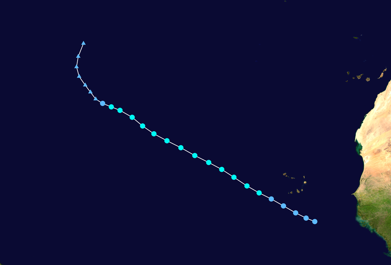
Tropical Storm Debby was the fifth named storm of the 2006 Atlantic hurricane season. It developed from a tropical wave that left the west coast of Africa and organized into a tropical storm on August 21, 2006 just off the African coast. Debby is an example of an early-season Cape Verde-type system that followed a generally northwestward track and reached a modest peak intensity before being disrupted.
Image gallery
10 Images




Meteorological development
Debby originated from a well-defined tropical wave that propagated westward across the eastern Atlantic. Initial organization occurred near the African coast, and the disturbance passed close to the Cape Verde islands as it strengthened. Maximum sustained winds were estimated near 50 mph (85 km/h), but persistent vertical wind shear and dry air intrusion prevented further intensification to hurricane strength.
Forecasts, warnings and observed effects
Early model guidance and operational forecasts showed a consistent northwestward track, and the National Hurricane Center produced advisories anticipating possible strengthening. Some forecasts predicted Debby could pass through or near the southern Cape Verde islands and raised concerns about heavy rainfall and localized flooding. Authorities issued watches or advisories for parts of the archipelago; forecasters also warned of the potential for life-threatening flooding in heavy-rain scenarios (flooding risks).
In practice the storm remained relatively compact and did not intensify into a hurricane. Computer models were more consistent on the track than on intensity; while many model runs suggested steady strengthening, environmental constraints—primarily shear—limited the storm's development. Forecast uncertainty illustrates a persistent challenge when predicting intensification for tropical cyclones emerging from African waves.
Dissipation and legacy
Debby weakened as it moved northwestward into less favorable conditions and eventually dissipated on August 27 over the northern Atlantic. Impacts were limited compared with stronger systems: there were reports of rain and gusty winds near the Cape Verde area but no major recorded damage. The storm is often referenced in seasonal summaries as a short-lived Cape Verde cyclone whose potential for rapid strengthening was curtailed by shear.
Key points and broader context
- Formation: developed from an African tropical wave on August 21, 2006.
- Peak intensity: about 50 mph (85 km/h); did not reach hurricane strength.
- Primary limiting factor: strong vertical wind shear.
- Forecasting: the NHC and numerical models tracked a northwestward path; intensity prediction remained difficult.
- Regional concern: potential impacts to the Cape Verde islands and associated local advisories for rainfall and flooding.
Debby illustrates common themes in tropical meteorology: many storms that form near Africa follow a Cape Verde trajectory but encounter widely varying environmental conditions. Even when track forecasts are relatively robust, intensity forecasts can diverge when factors like shear, sea surface temperatures and dry air interact. The storm's brief life and limited impact make it a useful case study for the limits of early intensification forecasts and for comparisons with other Atlantic tropical cyclones.
Questions and answers
Q: What is Tropical Storm Debby?
A: Tropical Storm Debby was the fifth tropical storm of the 2006 Atlantic hurricane season.
Q: When did Debby form?
A: Debby formed just off the coast of Africa on August 21 from a tropical wave.
Q: Where did Debby pass through?
A: After passing near the Cape Verde islands, Debby moved generally northwestward for much of its life.
Q: What was the peak intensity of Debby?
A: The peak intensity of Debby was 50mph (85km/h).
Q: Why did Debby weaken?
A: Strong wind shear weakened the storm.
Q: When did Debby dissipate?
A: Debby dissipated on August 27 over the northern Atlantic Ocean.
Q: What did computer models predict about Debby?
A: Most computer models consistently predicted Debby to move to the northwest throughout its lifetime, though intensity was more of a problem for forecasters.
Related articles
Author
AlegsaOnline.com Tropical Storm Debby (2006): formation, path, and meteorological summary Leandro Alegsa
URL: https://en.alegsaonline.com/art/101697
Sources
- nhc.noaa.gov : "Tropical Storm Debby Tropical Cyclone Report"
- nhc.noaa.gov : "Tropical Depression Four Discussion Two"
- nhc.noaa.gov : "Tropical Depression Four Discussion Three"
- nhc.noaa.gov : "Tropical Storm Debby Discussion Seven"
- nhc.noaa.gov : "Tropical Storm Debby Discussion Eight"
- nhc.noaa.gov : "Tropical Storm Debby Discussion Nine"
- nhc.noaa.gov : "Tropical Storm Debby Discussion Ten"
- nhc.noaa.gov : "Tropical Storm Debby Discussion Twelve"
- nhc.noaa.gov : "Tropical Storm Debby Discussion Sixteen"
- nhc.noaa.gov : "Tropical Storm Debby Discussion Eighteen"
- nhc.noaa.gov : "Tropical Depression Debby Discussion Nineteen"
- nhc.noaa.gov : "Tropical Depression Public Advisory One"
- nhc.noaa.gov : "Tropical Depression Four Public Advisory Four"
- foxnews.com : "Tropical Depression Reaches Cape Verde Islands"
- nhc.noaa.gov : "Tropical Depression Debby Discussion 23"