Travnik: Central Bosnian town, history, geography and cultural sights
Travnik is a historic town in central Bosnia and Herzegovina, known for its Ottoman-era heritage, fortress, proximity to Vlašić mountain and the Lašva valley. Population and location details included.
Overview
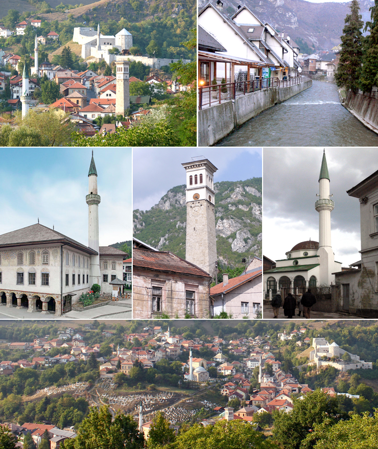
Travnik is a town in central Bosnia and Herzegovina, located roughly 90 kilometres west of Sarajevo. It serves as the administrative centre of the Central Bosnia Canton and is the seat of the Travnik Municipality. In the 2013 census the town reported 16,534 residents while the wider metropolitan area had about 57,543 inhabitants. Travnik's compact historic core and surrounding valley make it a regional hub for administration, local industry and tourism. For regional context see central Bosnia and the nearby city of Sarajevo. The town is the capital of the Central Bosnia Canton (administrative unit).
Image gallery
10 Images


Geography and environment
Travnik lies close to the geographic centre of the country at approximately 44.233°N, 17.667°E. The Lašva river runs west to east through the town and the Lašva valley forms a natural corridor connecting the Bosna river valley to the Vrbas river basin. The town stands at about 514 metres above sea level and is surrounded by rolling hills and higher mountains. Two nearby highlands of note are Vilenica and the Vlašić massif; Vlašić is near the national centre and its highest point, Paljenik, reaches about 1,943 metres. These features shape local climate, land use and outdoor recreation opportunities.
History and development
Travnik has a layered history. From the late 17th century it gained importance under Ottoman rule when, in 1699, it became a residence for the viziers of the Bosnian province and an administrative centre. Ottoman and later Austro-Hungarian influences left a legacy of fortifications, traditional houses and religious monuments. Over centuries Travnik developed as a market town and regional seat; today its townscape still reflects this complex past in streets, mosques, public buildings and the fortress that dominates the skyline.
Sights, culture and examples
The town is known for several well-preserved historical features that attract visitors interested in architecture and history. Typical attractions include a medieval and Ottoman-era fortress on a hill above the town, an ensemble of traditional Bosnian houses, old town streets and historic religious buildings. Museums and small cultural institutions interpret local history, crafts and the Ottoman administrative period. Travnik also acts as a gateway for visitors heading to the nearby Vlašić mountain for hiking and winter sports. For general visitor information consult regional resources such as metropolitan area guides.
Economy, transport and everyday life
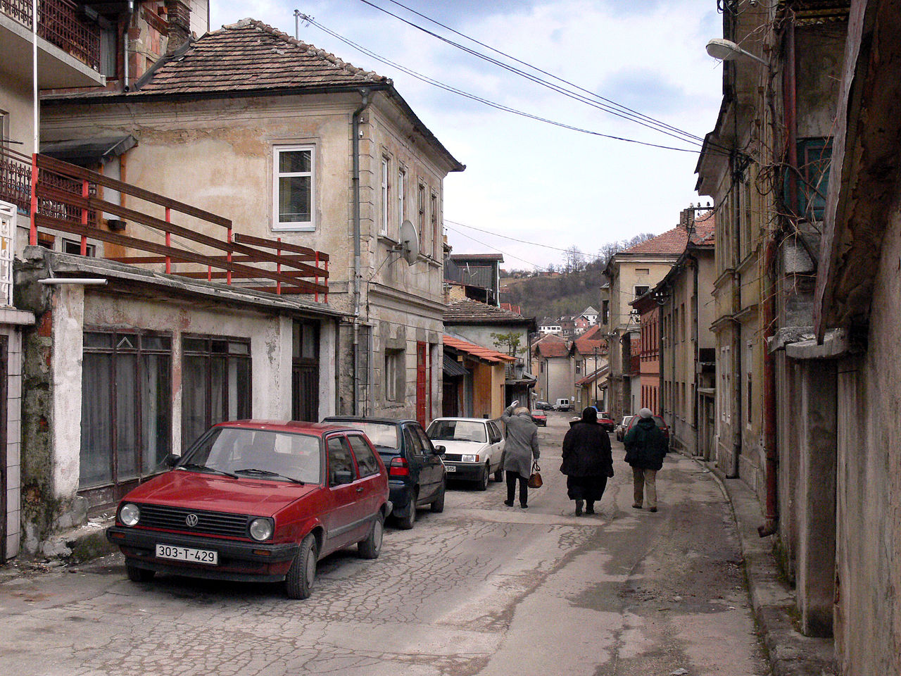
The local economy combines public administration, small-scale manufacturing, services and agriculture. Travnik's location in a valley and its road connections to larger cities support trade and commuting. Local markets, cafes and cultural events contribute to daily life and to attracting domestic visitors. The town is also associated with traditional Bosnian crafts and culinary specialties found in its cafes and family-run restaurants.
Notable facts and distinctions
- Historical: Travnik became a centre of Ottoman provincial government in 1699 and retains significant Ottoman-period architecture; see references to the viziers and the Ottoman province.
- Geographic: It sits near the national centre of Bosnia and Herzegovina and occupies an important valley route linking major river basins.
- Recreation: Proximity to Vlašić mountain makes Travnik a base for mountain tourism and outdoor activities.
For further reading and visitor planning consult local and regional sources (central Bosnia resources, Sarajevo area links) or municipal information available through official channels. Additional context and maps can be found via general geographic and cultural references (cantonal information, administrative guides, metro guides).
Questions and answers
Q: What is the name of the town in Bosnia and Herzegovina?
A: The town is called Travnik.
Q: How far is it from Sarajevo?
A: It is 90 kilometres (56 miles) west of Sarajevo.
Q: What year did it become the residence of the viziers of the Ottoman province of Bosnia?
A: In 1699, it became the residence of the viziers of the Ottoman province of Bosnia.
Q: What geographical features are found near Travnik?
A: Near Travnik there are Vilenica and Vlašić mountains.
Q: What is the elevation at Vlašić mountain's highest peak?
A: The highest peak at Vlašić mountain has an elevation of 1,943 metres (6,375 ft).
Q: How high above sea level is Travnik located?
A: Travnik is 514 metres (1,686 feet) above sea level.
Q: What river flows through Travnik?
A: The river Lašva flows from west to east through the city.
Related articles
Author
AlegsaOnline.com Travnik: Central Bosnian town, history, geography and cultural sights Leandro Alegsa
URL: https://en.alegsaonline.com/art/101265
Sources
- ovguide.com : "Travnik Video, Tourism and Events"
- anu.edu.ba : "Travnik"
- traveltill.com : "Location of Travnik"