Trang province — geography, history, economy and attractions
Trang is a coastal province in southern Thailand on the Andaman Sea, known for its karst islands, rubber cultivation, rivers and a history as an important trading port.
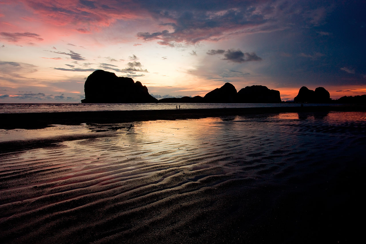
Trang is a province in southern Thailand facing the Andaman Sea. Covering roughly 5,000 square kilometres, it combines a hilly mainland, fertile river valleys and an archipelago of about 46 islands. The provincial capital, also named Trang, grew up as a coastal trading centre and remains a regional hub for agriculture, fisheries and tourism. Its landscape and coastal waters make Trang distinct among southern Thai provinces.
Image gallery
10 Images


Geography and natural features
Trang's terrain is dominated by low mountain ranges and forested hills that form the watershed for several rivers. The main rivers, the Trang River and the Palian River, descend from the slopes between the Khao Luang and Khao Banthat ranges toward the coast. Offshore, limestone karst formations create dramatic islands, coral-fringed beaches and sea caves that attract visitors and support local fisheries.
- Major rivers: Trang River, Palian River.
- Mountain ranges: Khao Luang range, Khao Banthat range.
- Notable islands and marine sites: Koh Kradan, Koh Muk (home to the Emerald Cave), and numerous smaller islets.
History and development
Historically Trang served as a port on the Andaman coast and took part in regional trade networks. In the late 19th century the province became a centre for new agricultural enterprises: it was the first area in Thailand where rubber was planted experimentally, when provincial authorities brought seedlings from neighbouring areas and began cultivation. Over time rubber cultivation spread across southern Thailand and became an important export crop. Trang also experienced periods of tin mining and coastal trade that shaped its towns and economy.
Economy and land use
Agriculture remains a cornerstone of Trang’s economy, with rubber and oil palm plantations, rice cultivation in valley bottoms and shrimp and fish farming along the coast. Tourism centered on beaches, island snorkeling and cave exploration has grown steadily, supported by ferry routes and local hospitality businesses. The port heritage and fertile soils continue to influence local markets and livelihoods.
Climate and seasonal patterns
Trang lies in the monsoon-influenced tropics. The island and coastal climate is shaped by the southwest monsoon from the Indian Ocean, which produces a pronounced wet season and periods of heavy storms in the peak months. A comparatively drier period occurs later in the year, when seas are calmer and island beaches receive more visitors.
Culture, travel and notable facts
Local culture reflects a blend of Thai and regional Malay influences, visible in place names, food and community celebrations. Travelers are drawn to Trang for its relatively unspoiled islands, limestone caves and seafood cuisine. Among notable facts: Trang was among the first provinces in Thailand to introduce commercial rubber planting, and its mainland–island combination offers both inland hill scenery and accessible marine attractions.
Further reading and resources: Andaman Sea and coastal ecosystems, regional connections with Malaysia, rubber cultivation in Thailand, monsoon climate patterns, Malay linguistic and cultural influence, and local place-name history.
Questions and answers
Q: Where is Trang located?
A: Trang is located in the southern provinces of Thailand on the Andaman Sea.
Q: What is the area of Trang?
A: Trang has an area of around 5,000 square kilometres (1,900 sq mi).
Q: What are the important rivers in Trang?
A: The important rivers that flow through Trang are the Trang River and Palian River.
Q: What mountain ranges are situated between the rivers in Trang?
A: The Khao Luang mountain range and the Khao Banthat mountain range are situated between the rivers in Trang.
Q: What was Trang's role in the past?
A: Trang used to be a port involved in foreign trade and transportation.
Q: Who introduced rubber trees to Trang?
A: Governor Mahison Phakdi brought rubber from Malaysia and planted it in Trang in 1899.
Q: When is the monsoon season in Trang?
A: The monsoon season on the Andaman Coast runs from June to September in Trang.
Related articles
Author
AlegsaOnline.com Trang province — geography, history, economy and attractions Leandro Alegsa
URL: https://en.alegsaonline.com/art/101095