
Toronto subway
Overview of the Toronto subway system: organization, lines, history, key expansions, ridership and notable features of Canada's largest urban rapid transit network.
Overview
The Toronto subway and intermediate-capacity lines form the core of rapid urban transit in Toronto, Ontario, Canada. Operated by the Toronto Transit Commission, the network combines conventional heavy-rail subway lines with legacy light-metro segments to carry commuters across the city and into nearby suburbs. It is commonly described as a rapid transit or railway system because it provides frequent, grade-separated rail service independent of street traffic.
Image gallery
10 Images




Lines, stations and infrastructure
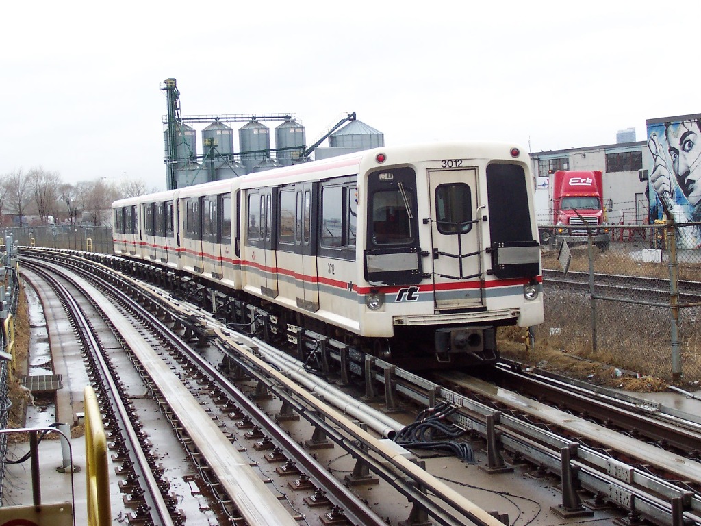
The system now comprises multiple lines that serve downtown, midtown and suburban corridors. The spine of the network is the Yonge–University Line, which originally followed Yonge Street through the city core. Combined with other routes, the network covers roughly the same order of magnitude as most major North American city subways, with dozens of stations and dozens of kilometres of track; modernization and extensions have steadily increased its reach over time (track and station data). Lines vary in scale: some are full heavy-rail subways offering eight‑car trains and high capacity, while others use shorter trains and different signalling suited to intermediate demand.
History and major expansions
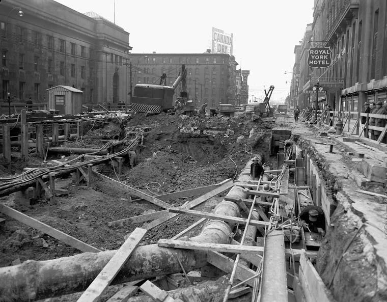
The first segment of what became Toronto's subway opened in the 1950s beneath the city's principal north–south corridor. Subsequent decades saw phased expansion across east–west and circumferential routes, along with new stations and rolling stock. A major 21st-century project extended the Yonge–University corridor northward into York Region; this initiative involved provincial contributions announced in the 2000s and construction of several new stops around university and suburban employment centres. Provincial government announcements included capital commitments for the extension project, and the public record described funding arrangements such as a multi-hundred-million-dollar provincial contribution (public funding).
Notable stations and ridership
Several transfer hubs concentrate passenger flows; central stations link subway lines with surface streetcar routes and regional buses. Historically the system has been among the busiest in Canada, with weekday ridership measured in the high hundreds of thousands in earlier decades (ridership figures). Important new stations added during recent expansions serve academic campuses such as York University and major arterial roads like Steeles Avenue, improving connections between neighbourhoods and employment zones.
Uses, operation and future plans
- Primary use: daily commuter travel to and from the core and between major nodes in the metropolitan area.
- Integration: fares, surface transit and regional connections aim to create seamless journeys for riders across modes.
- Capacity and upgrades: projects address crowding, accessibility improvements, and signalling and vehicle renewal to increase throughput.
Distinctive features and considerations
The Toronto network is distinguished by its mix of vehicle types and historical layers—ranging from original 1950s subway alignment to later cut-and-cover and bored tunnels, short branch lines, and more recent suburban extensions. Debates over replacement of older light-metro segments, funding for expansion, and the balance between rapid regional links versus local coverage have shaped planning decisions. For readers seeking official updates, technical reports and service notices are published by transit authorities and regional agencies (operator information, system reports, municipal pages, provincial summaries, national context, TTC resources, corridor history, infrastructure data, ridership studies, line descriptions, campus connections, arterial links, government notices, funding announcements).
The Toronto subway remains a central part of daily life for many residents and a continuing focus of urban planning, investment and debate as the region grows and travel patterns evolve.
Questions and answers
Q: What is the Toronto subway and RT?
A: The Toronto subway and RT is the main rapid transit (RT) railway system in Toronto, Ontario, Canada.
Q: Who runs the Toronto subway and RT?
A: The Toronto subway and RT is run by the Toronto Transit Commission (TTC).
Q: When did the first part of the Toronto subway and RT open?
A: The first part of the Toronto subway and RT opened in 1954 with 12 stations.
Q: How many lines and stations does the Toronto subway and RT have?
A: The Toronto subway and RT has four lines and 69 stations on 68.3 km of track.
Q: How many passengers does the Toronto subway and RT have each weekday?
A: The Toronto subway and RT has an average of 948,100 passenger trips each weekday (as of 2010).
Q: Where was the Toronto subway and RT made bigger with new tracks and stations?
A: The Toronto subway and RT was made bigger on the western part of the Yonge–University Line with new tracks and stations being made north to York University, Steeles Avenue, and Vaughan Corporate Centre in York Region.
Q: How much money was given by the Government of Ontario for the new track and stations made in the Toronto subway and RT?
A: The Government of Ontario said on March 23, 2006 that it will give $670 million for this new work, which is less than one-third of the total money needed.
Related articles
Author
AlegsaOnline.com Toronto subway Leandro Alegsa
URL: https://en.alegsaonline.com/art/100724
Sources
- transit.toronto.on.ca : "Transit Toronto Subway Pages"
- transit.toronto.on.ca : "Toronto's Lost Subway Stations"
- toronto.ca : "Rapid Transit Expansion Study (RTES)"
- toronto.ca : "Rapid Transit Expansion Study (RTES) – Follow-Up Report"
- toronto.ca : "Spadina Subway Extension"